DODOMA REGION
Background information; by edgardowelelo@yahoo.com
 TOURISTS FREQUENTLY ASKED QUESTIONS
- Where in East Africa would one find the famous rock – painting sites attributed to late Stone Age Peoples, although some are of a more recent origin?
- Answer
They are known as the Kolo or Kondoa Rock Paintings in north – central, Dodoma Region, Tanzania.
- DODOMA REGION AT A GLANCE
Dodoma Region has the potential for tourism to attract tourists and investment. Among these are the Kolo Cave Paintings in Kondoa Irangi, the Kongwa Grave Yard, a thriving cattle ranch and the former site of the abandoned ground nut scheme of the OFC of the United Kingdom. Others are grape farming and wine manufacturing at the Bihawana and Makutupora JKT grapevines. The region is also home to the Kizigo – Ruaha National Park and Rungwa Game Reserve.
 Dodoma Region lies in the heart of Tanzania in the eastern – central part of the country, the main city being about 300 miles (480 km) from the coast. The region, which is primarily Semi-arid, covers an area of 41,311 square Kilometers (15,950 Sq. miles). Historically, Dodoma was a stopover on the overland caravan route that travelled from the Swahili Coast inland towards Lake Tanganyika. Dodoma (Literally “it has sunk” in Gogo, one of the indigenous ethnic group of Dodoma region). Dodoma is the nation’s official capital and the seat of government in the country. Dodoma remains a center for national politics. Situated on the eastern edge of the Southern highlands, the city is surrounded by a rich agricultural area and pleasant scenery.
It is the center of Tanzania’s growing wine industry and the Tanganyika vineyards company is actively promoting its products. Early in the 20th century, the city became a major point on the Central Line Railway, which carried agricultural crops for export to the harbor in Dar es Salaam. In 1973, plans were made to move the capital to Dodoma. Tanzania’s National Assembly (Bunge) moved there in February 1996, but many government offices remain in the previous national capital, Dar es Salaam, which remains the commercial capital. A popular tourist destination is the Lion Rock. Those with enough energy to hike to the very top will be able to enjoy un interrupted views across the whole of Dodoma.

ATTRACTIONS IN DODOMA REGION AT A GLANCE
- Visiting the parliament of Tanzania in Dodoma Region.
- Visiting the Kwamtoro village in Chemba district which is mostly dominated by Wasandawe people whose language is in the same family as some ethnic groups found in Namibia and South Africa.
- Visiting the Kondoa Rock Art Sites. This site was nominated as a World Heritage Sites in 2006 and is located in Kondoa District, Dodoma region. The sites spread over 2336 square kilometers on the eastern escarpment of the East African Rift Valley.
- Visiting the department of Antiquities in Kolo. The Kolo sites which are closer to the main road, Arusha to Dodoma, and just 20 km from Kondoa town, are the most popular among visitors and researchers. The rock paintings are believed to be drawn by the Sandawes and Hadzabes. between 1500 and 800 years.
Background information; by edgardowelelo@yahoo.com
 Dar es Salaam Region in Brief:
- Dar es Salaam, literally “the haven of Peace,” or simply Dar, formerly Mzizima) is Tanzania’s largest and richest city, the largest city in eastern Africa by population, and is a regionally important economic centre. The city is the largest and most populous Swahili speaking city in the world. It is the capital of the Dar es Salaam Region administrative province and consists of three administrative districts; northern Kinondoni, central Ilala, and southern Temeke. The area of Dar es Salaam Region is 1,393 Sq.km, and this make Dar es Salaam to be the smallest region in Tanzania by an area. During German occupation in the early 20th century, Dar es Salaam was the centre of colonial administration and the main contact point between the agricultural mainland and the world of trade and commerce in the Indian Ocean and Swahili coast. Remnants of a colonial past, both British and German, can still be seen in landmarks and architecture around the city. The National museum, the village museum, and many landmarks, including St Joseph’s Cathedral, the White Father’s Mission House, the Botanical Gardens, and the Old State House make for an interesting walking tour around the waterfront and city centre. There is a fusion of cultural influences; Arab, Indian, German and British influences can be found in the city’s architecture. Dar es Salaam is Tanzania’s most prominent city in arts, fashion, media, music, film and television. Down at Kariakoo, cheerful Tinga Tinga paintings are stacked next to folded piles of Khangas and kitenges, traditional medicines sit alongside near pyramids of fruits and vegetables as shopkeepers sell their goods. Tourists are well catered for, with a choice of accommodation for all budgets, from backpacker hostels to five star hotels. For the business traveler, there are a number of hotels offering world class conference and accommodation facilities. There is a wide array of restaurants offering Thai, Indian, Italian, Japanese, Ethiopian cuisine and more. Of course, you can also find local restaurants serving chips (French fries), ugali and nyama choma (freshly grilled meat). If you are a street foodie you can try the mishkakis (grilled beef or chicken skewers) and fried Muhogo (tapioca) clipped in spicy chili sauce sold at the street kiosks at the Oysterbay Beach located on the peninsula. Dar es Salaam has an electric live music scene. Traditional taarab orchestras rub shoulders with dance bands playing jazz, salsa, and afro funk. Rap, hip – hop and bongo flava artists collaborate and perform around the city. For the art and history aficionados, the National Museum, Botanical Gardens and Village Museum are another diverting way to spend a day, tracing the history of Tanzania, from prehistoric fossils through to the relics of colonialism. Beyond the museums, music and art found in the city centre, visitors could cross over to Kigamboni by a 10 minutes ferry ride where they spend the morning at the waterpark or just relax and catch a tan at the popular Mikadi Beach. Dar has its own selection of spectacular beaches at Kunduchi, Mji mwema and Jangwani. At Jangwani, there is snorkeling and diving on offer, with the chance to see tuna, Kingfish and even the white tipped reef shark.
25 Fun Things To do in Dar es Salaam.
Bongoyo Island:
- Bongoyo Island is a small island off the coast of Dar es Salaam that makes a fantastic day trip of lazying on the beach, snorkeling and dining on fresh fried fish and chips. Since becoming a marine reserve a few years ago, fees have severely increased, but it is still worth it. Get to the island by taking a boat from the Slipway Shopping Center.
TingaTinga Art Center:
- Tanzanians have long been famous around Africa for their art work (even on the streets of Dar). The modern movement of Tingatinga painting is one of the favorite styles of Tanzania art. An artistic movement that began with Edward Said Tingatinga, the style is characterized by extremely bright oil colors and animated imaginative figures. The Tingatinga center is a rainbow of color and artistic inspiration. You can browse around and buy anything you see.
Coco Beach on the weekends:
- Coco Beach, also known as OysterBay, is a stretch of beach located on the Msasani Peninsula of Dar es Salaam. If you are looking for fun things to do, head over to Coco Beach on the weekend when it is packed full of local Tanzanians and Asians. There are plenty of street food snacks and sometimes live music. The open area is also a place where frequent concerts and parties take place – check the city events guide. Swimming is not really recommended at Coco Beach, though some choose to wade in the water.

Askari Monument:
- One of the most well - known historical statues of significance in Dar es Salaam is Askari Monument. Depicting a soldier with his bayonet pointing to the harbor, the monument is a reminder of the soldiers that fought as the Carrier Corps in world war I. The cast bronze Askari Monument is supposedly located in the precise center of Dar, in the middle of the round about that bisects Samora Avenue with Maktaba Street.
Tanzanian Beverages:
- Everywhere you travel you will encounter a new and unique set of local beverages. When you are in Tanzania you may want to sample the selection of locally brewed beer, have a few cups of Dar street coffee and especially guzzle a pungent Stoney Tangawizi.
National Museum:
- If you want to learn more about the history and culture of Tanzania or see some of the fossils that have been uncovered in the country, you will be interested in visiting the National Museum.
Mwenge Carvers Village:
- Located on the outskirts of town, Mwenge carvers’ village is a great attraction in Dar es Salaam if you are in the market for Tanzanian souvenirs. Though there is a lot of the same – same type of things, if you take the time to browse around you will come away with some unique and quality Tanzanian handicrafts.
Zanzibar Mix:
- There is one dish in Dar es Salaam that is rare, but is a gem of an example of an expertly prepared dish that sums up the realm of cultures and traditions of the city: Zanzibari Mix. Zanzibar Mix is incredible – a comforting combination of deep fried fritters in a coconut milk curry and garnished with fresh chutneys and chili sauce.
North Beach – Jangwani and Mbuja Island
- North of Dar es Salaam there are a few lovely beaches and islands to enjoy as well. From White Sands Hotel in Jangwani, you can take a boat to Mbuja island, a great place to unwind and eat freshly caught Indian seafood.
Indian Food:
- With a sizable population of Indians, there is a decent selection of delicious Indian food available (just like with Kenyan food). The Upanga area, in central Dar, is one of the best areas of town to locate good Indian food.
Pugu Hills Nature Reserve:
- Pugu Hills is a designated nature reserve located around 25 Kilometers from the center of Dar es Salaam. Along with an opportunity to hike the trails, you can also choose to bird watch or visit the cave which is famous for its colony of bats. You can either get to Pugu Hills on your own or take a day tour.

Kariakoo Market:
- One of the busiest and most thrilling markets in Dar es Salaam is the local Kariakoo market. This is the place to go if you are hunting for the best bargains in town or wish to see the authentic side of local style Tanzanian shopping. Make sure you haggle to get the best deals. Be cautious with your money and possessions as Kariakoo is a bustling crowded place.

Temple Road:
If you are walking around downtown, take a stroll down Temple Road where you will find a selection of religious temples. There is not much else to do, but you can visit a few of the temples and have a look around.
Kanga shopping – Uhuru St
- A popular thing to buy in Dar es Salaam are the colorful pieces of wrap around cloth known as Kangas. These brightly dyed rectangles of fabric are available in infinite colors, with infinite patterns and often include a message written in Kiswahili. Head over to Uhuru street in down town for a huge selection of Kangas.
Azania Lutheran Church:
- Originally built by German Missionaries in Tanzania, the Azania Lutheran Church is an iconic structure located at Dar es Salaam’s harbor front. From the cathedral you will have easy access to other tourist attractions around town.

Nyama Choma:
- Just like in neighboring Kenya, nyama choma (roasted meat - often goat) is wildly popular and incredibly delicious. Go to a local restaurant, order your choice of meat and wait for it to slowly roast. In Tanzania, nyama choma is served with a few chillies and sometimes tomatoes and red onion garnish. Many Tanzanians choose to wash down their nyama choma with a few beers.
Tanzania Street Food
- Whether it is roasted maize or mama cooked Tanzanian chapatis, also try Mishkaki which is the Tanzanian version of meat on a stick – street style shish kebabs!
South Coast Beaches
- There are a number of hotels that you can visit, or you can rent your own personal banda thatch covered hut for the day. The lanky palm trees rustling in the breeze and the rhythmic wash of waves makes spending a day on the South Coast Beaches one of the most relaxing things to do. One of the best things to do is to go horse riding on one of the best beaches you will ever encounter. The Dar Horse Club is located near the world famous Ras Kutani Resort. Get there by personal vehicle or by local daladala minivan. You will need to cross to the Kigamboni side of Dar by taking the ferry across the port.
Swahili Delicacies
- Only open in the evenings Mamboz is famous for its barbeque chicken and chips, located on Libya street in the centre of Dar. Other places to try matoke (green banana) are chef’s pride (Chagga Street Central Dar) or Jamaa Restaurants (One located near Askari Monument the other, one block from Azam Zanzibar Ferry Terminal).
Night Life
- The Good, the Bad and the Funky – there are two spots that have risen in statures as the best places to enjoy the evening with a bunch of mates; Dar Live and DAR LIVE has a Zanzibar feel to it, being on the beach, and is open and very casual. The bar is on the beach, nestled among Dhow furniture in a most rustic fashion, open throughout the week. Runway is the opposite, a modern up class liquor lounge, styled in the latest international chic design. Best to go are Saturdays and Sundays. The George and Dragon has a very strong expat following with various activities every night to keep anyone entertained. Club Maisha has a more local following and is the leading Night Club in term of strobe lights, dance floor and multilevel facility. Latest on the block and with the best views of Dar by night is High Spirit Bar, Lounge & Night Club located on the roof top of IT plaza Ohio Street.
Village Museum
- More of a hand on than the National Museum, the village museum offers a chance to observe a number of typical style Tanzanian traditional huts and learn more about the tribes of the country. Dance and drum performances are held in the evenings on weekends.
Dar es Salaam Fish Market
- One of the favorite things to do is wake up early in the morning and wander around the Dar fish market. People gather from around the city to purchase the fresh catch of the day. Arrive at around 6.30 am to catch the mot energized fish auctions taking place.

Bagamoyo Town
- Similar to Mombasa or Lamu. Bagamoyo town located north of Dar es Salaam, is an ancient East African trade port. The town has been influenced by Arabs and Indians to create a uniquely Swahili culture. On a day trip to Bagamoyo, you can visit ancient ruins, old churches and mosques and tour one of Tanzania’s only college of arts known as Chuo Cha Sanaa Bagamoyo. If you don’t have your own transportation, you can get to Bagamoyo by local bus or by taking a day tour.
The Slipway
- The slipway is Dar es Salaam’s premier shopping and leisure centre. Here, you can shop, drink, dine or watch the sunset over the Indian Ocean. Parents can set their children loose in around waterfront playground and travelers can relax in lovely hotel rooms.
Fishing
- Latham Island (Fungu Kisim Kasi) is a small, uninhabited oceanic island. The island and its associated reefs stick out the Indian Ocean in the middle of nowhere an insignificant pinhead in the Indian Ocean. This structure promotes currents, and provides haven for baitfish and their predators and is thus a great big game fishing destination. The island lies 45 nautical miles East of Dar es Salaam so may be fished on a day trip or more advisably on an overnighter, during which the adventurous angler can try to the mighty Broadbill Swordfish. There are several charter operators out of Dar, and they generally fish at Latham itself or for shorter and cheaper outings, work the Zanzibar channel. Both fisheries can provide exciting sport – offering chances at Black and Striped Marlin, Sailfish, Wahoo, Yellow fin such as Grouper and Red Snapper, and many more. It is an angler’s paradise. If you have a day off in Dar and love to hear a big real scream, don’t hesitate to take off into the blue water, it’s right at your feet.
Background information; by edgardowelelo@yahoo.com
 A town, as the city is fondly referred to, owes her magnificence to many aspects. The town sits at the foothills of Mount Meru in a location surrounded by nature’s gems. Arusha’s history is a fascinating compilation of fate and an elaborately structured vision that begun on the onset of the 1900s. Arusha was established as a Garrison town by German colonialists and named after the local Wa – Arusha or Larusa tribe. The Landscape surrounding Arusha teems with various well known natural attractions including Ngorongoro crater, Lake Manyara, Oldupai Gorge, Tangangire National Park, and the Arusha National Park. Because of this strategic location, Arusha is regarded as the gateway to all northern circuit tourism destinations in Tanzania. It has been said that safaris start and end in Arusha with its famous national parks and tourist attractions in the northern circuit. The city of Arusha is a cosmopolitan town and also a significant diplomatic hub. The city is currently the headquarters and de – facto capital for the East African Community (EAC). One of the most notable features of Arusha town is the Clock Tower which is said to be the center of Africa and midway of the highway from Cape town to Cairo.

TOURIST ATTRACTIONS IN ARUSHA REGION
Although the city is mainly regarded as a transit center, Arusha offers several tourist attractions that will fascinate any visitor.
ARUSHA NATIONAL PARK (ANAPA)
Arusha National Park is considered to be a little gem in Tanzania’s Northern Safari Circuit,” just 40 minutes’ drive from the safari gateway town of Arusha. The park is made up of three particular features; lush swamps of the Ngurdoto crater, changing colors of Momela Lakes and rugged alpine peaks of Mt Meru. Habitat ranges from highland Montane forest to lowland swamp.

LAKE DULUTI FOREST RESERVE
- Lake Duluti is a wonderful Crater Lake, as its waters appear green due to reflection of forest vegetation around it. Apart from ground flows and forest catchment, it is supplemented by underground flows. It covers 62 ha with its deepest point of 700m. The water is cool with low currents thus suitable for canoeing and spot fishing activities.
ARUSHA DECLARATION MUSEUM
- Arusha Declaration Museum holds several displays and exhibitions portraying the glorious struggle of the people of the land. You will know here about the fight for sovereignty, the majestic and glorious history and the political expansion of Tanzania.
MESERANI SNAKE PARK
- The snake park is located 25 kilometers west of Arusha en - route to the Serengeti National Park and Ngorongoro Crater. It is home to a variety of snakes common to eastern and southern Africa including the Black Mamba and the African Python.
KILIMANJARO GOLF & WILDLIFE ESTATE
- The Kilimanjaro Golf and Wildlife Estate comprises an 18 – hole championship golf course together with a real estate development set within an area of outstanding natural beauty. The beauty of Tanzania’s northern highlands provides the spectacular setting for this estate, the newest and most striking addition to Africa’s great golfing estate.
Visit the Eastern and Southern African Management Institute (ESAMI) and the Nelson Mandela African Institute of Science and Technology (NMAIST – Arusha)
Visit the African Court on Human and People’s Rights (ACHPR) and the East, Central and Southern Africa Health Community (ECSA – HC)
Visit Tarangire National Park and Ngorongoro Conservation Area Authority (NCAA).
TOURISM NORTHERN CIRCUIT
Northern Tanzania is a prime destination offering some of the world’s most diverse safari opportunities. The Great Wildebeest Migration, one of the most amazing wildlife spectacles can be caught at the Serengeti, whilst being on Safari on the Crater floor of the extinct volcano at Ngorongoro is a game viewing environment that has no equal. Towering above it all is Kilimanjaro, the world’s highest freestanding mountain and arguably Africa’s toughest challenge.
NORTHERN CIRCUIT ATTRACTIONS
LAKE MANYARA NATIONAL PARK
- Stretching for 50 km along the base of the rusty – gold 600 – meter high Rift Valley Escarpment, Lake Manyara is a scenic gem, with a setting extolled by Ernest Hemingway as “The loveliest I had seen in Africa”. The entrance gate lies 1.5 hours (126 – 130 km) west of Arusha close to the ethnically diverse market town of Mto wa Mbu.
NGORONGORO CRATER
- This is a deep, volcanic crater, the largest un – flooded and unbroken caldera in the world. About 20kms across 600 -610 meters deep and 300 sq. km in area, the Ngorongoro crater is a breathtaking natural wonder.

TARANGIRE NATIONAL PARK
- The park enjoys the greatest concentration of wildlife outside the Serengeti ecosystem. It is a smorgasbord for predators, and the one place in Tanzania where dry country antelope such as the stately fringe – eared oryx (Choroa) and peculiar long – necked gerenuk are regularly observed.
LAKE NATRON
- Lake Natron is a Salt Lake located close to the Kenyan border, in the eastern branch of the East African Rift. It is the most important breeding site for lesser flamingos in the world. East Africa has 1.5 to 2.5 million Lesser Flamingos, representing three – quarters of the world population and most of them are hatched at Lake Natron.
OLDONYO LENGAI
- “Oldonyo Lengai” means “The Mountain of God” in the Maasai language. The summit of this strato – volcano is 2962 meters above sea level, and affords direct views into the caldera of Tanzania’s only officially – certified active volcano and the world’s only carbonatite volcano. Records of eruption have been maintained 1883, the largest of which deposited ash 100 kilometers away in Loliondo on the Kenyan border to the north west.
MT MERU
- Mount Meru is an active strato volcano located 70 kilometers west of Mount Kilimanjaro. At a height of 4,565 meters (14,977 ft), it is visible from Mt. Kilimanjaro on a clear day, and is the ninth or tenth highest mountain in Africa.
FOOD AND DRINKS IN ARUSHA
- Vama the Restaurant
TFA shopping complex, Arusha.
- The Greek Club
Serengeti Road, Arusha.
- The Flame Tree
Themi Hill, Arusha.
- The Blue Heron
Haile Selassie Street, close to AAR, Arusha.
- The Baobab Restaurant
Serengeti Road, Corridor Area.
- Silk Club and Restaurant
St. Benjamin Road, Crastal Building.
- Seven Up Restaurant
Nairobi Road, Sakina.
- Sizzle Multi – Cuisine Restaurant
Njiro Shopping Complex, Arusha.
- Nicks Pub
Nane nane Area, Njiro ward.
- Mezza Luna
Moshi – Road, Arusha.
- MC Moody’s
Sokoine Road / Market Street.
- Intimate Places
Mt. Meru Game Lodge, Arusha.
- Galaxy Club
Col. Middleton Road, Kaloleni.
- Florida Inn 2000
Col. Middleton Road, Kaloleni.
- Everest Old
Moshi – Road, Arusha.
- Empire Sports Bar
TFA Arusha Shopping Centre, Arusha.
- Ciao Gelati
TFA Arusha Shopping Centre, Arusha.
- Chocolate Temptation
TFA Arusha Shopping Centre, Arusha.
- Cafe Mambo Espressi Bar & Bakery
Serengeti Road, Down from Barclays Bank, Arusha.
- Boogaloo Pub & Night Club
Lemara / Njiro, Njiro Complex
SHOPPING
- AIM Mall Arusha

- TFA Shopping Complex and Njiro Complex
NIGHT CLUBS
- Triple “A” Club
- Klub Afriko
Kimandolu – Moshi Road.
- Mawingu City Centre
WHERE TO STAY (ACCOMMODATION) HIGHLIGHTS & RECOMMENDED HOTELS
KIBO PALACE HOTEL
- Named after the highest peak of Africa’s highest Mountain – Mt Kilimanjaro, Kibo Palace Hotel is one of Arusha’s most exciting and innovative luxury hotel; contemporary, conductive and un conventional, a luxury hotel with a new attitude. Located in the heart of Arusha, gateway to the world’s most renowned game parks, it is a 45 – minute drive from Kilimanjaro International Airport (KIA) and a 15 – minute walk from Arusha city center and the Arusha International Conference Centre (AICC).

THE ARUSHA HOTEL
- Arusha’s supreme boutique hotel offering first class accommodation and service, surrounded by the history of bygone eras. The hotel boasts the finest location in the heart of Arusha, in the tranquil surroundings of its own tropical gardens.
EAST AFRICAN ALL SUITES HOTEL & CONFERENCE CENTRE
- Situated right in the heart of Africa in Arusha town, this unique boutique Hotel is easily accessible and convenient. The East African All Suite Hotel offers spacious suites which caters to your every personal comfort, your professional needs are also met with the business center and modern conference and banqueting facilities.
ECO BOMA CAMP
- This is undoubtedly the place to be for clients who want to feel the true unspoiled spirit of Africa’s nature and savannah plains. The camp is positioned at the edge of Migungani (acacia tree) forest and the plains of Lake Manyara where wild animals roam freely at night and Maasai cattle graze in the plains by day. The camps location is special because it is the only place you can see the sunrise from the far east along the rift valley and sundown on the west inside the Lake Manyara.
MOUNT MERU HOTEL
- Situated at the foothills of Mount Meru in the city of Arusha, Tanzania, the Mount Meru Hotel lies on 9 acres of lush landscape, surrounded by some of Africa’s most breath – taking vistas, rich with a diverse array of wildlife, etched against the fertile slopes of this beautiful mountain.

THE AFRICAN TULIP HOTEL
- The African Tulip is an elegant and charming Luxury Boutique Hotel located along Serengeti Road right in the heart of Arusha. A warm and friendly welcome awaits guests who want to experience the best of Tanzanian hospitality. The hotel has been designed with safari travelers business persons, families, honeymooners, elite and leisure travelers in mind. It has amenities of convenience whilst offering a high standard of luxury.
IMPALA HOTEL
- The hotel is located along the Old Moshi and Simeoni Road, Kijenge in Arusha, about 2 minutes’ drive from the city center, 45 minutes from Kilimanjaro International Airport and 10 minutes’ drive from Arusha Airport. Impala Hotel is strategically placed along cross roads that will bring you to the beautiful and pristine beaches, to the timeless Zanzibar Islands, to the most renowned game parks and game reserves, probably in the world and to the comfort of the transfers to closest airports.
LAKE DULUTI SERENA HOTEL
- Nestled at the foot of the wooded slopes of Mount Meru, this unique hotel stands amid coffee plantations on the shores of tranquil Lake Duluti. The Hotel offers a range of tastefully presented cottage – styled rooms set amid extensive landscaped grounds. The area boasts of a broad range of attractions, which include walking, mountain biking, canoeing on the lake, and trips to the nearby Arusha and Mount Meru National Parks.
THE PALACE HOTEL
Palace Hotel Arusha stands out against the backdrop of Mount Meru. It is an incredible harmony of shapes and colors. The Palace Hotel Arusha stands out as a remarkable adventure in hospitality. The hotel offers a wide range of rooms to suit the needs of both business travelers and holiday makers to the great city of Arusha
Background information; by edgardowelelo@yahoo.com
 Kilimanjaro Region in Brief:
Kilimanjaro Region is famous for its snowcapped Mount Kilimanjaro, with the highest peak at 5,895 meters above sea level, and adjacent to it within the region is the stretch of North and South Pare Mountains 2,000 – 2,500 meters above sea level. The region is divided into six (6) administrative districts, namely; Moshi(Rural & Urban), Rombo, Mwanga, Same, Hai, and Siha. The Region is also bordering with the Republic of Kenya which is an opportunity to be exploited in the promotion of trade among the seven (7) East African Community member states.
Moshi, is a small but typically vibrant town, situated at the slopes of Mount Kilimanjaro. What makes Moshi special is the fact that it sits in front of one of the world’s most amazing backdrops, the snow – capped Mt. Kilimanjaro. You can practically be anywhere in Moshi and feel imposed by the beauty of the Mountain. The town is set in a fertile volcanic area, well fed by streams off the mountain, ideal for Arabica coffee crops, the most rewarding local export. Moshi is the Kind of town where you can relax in its friendly atmosphere and just talk to people and observe the sights and sounds. Tourists are recommended to try and spend a few days here just absorbing what a typical market town in Tanzania can offer. This is the kind of town where people have the time to talk to you and be a friend. There are many interesting and picturesque excursion and tours you can take while you are staying at Moshi township.

THINGS TO DO WHILE IN MOSHI
- Besides climbing the famous roof of Africa and see the BIG FIVE in the Northern Circuit of the Tanzanian National Parks, Moshi and its surroundings offers a great variety of day trips to extend your stay. Sightseers visiting Moshi may also like to check out the central mosque and the town’s various religious institutions, and perhaps the Commonwealth War Cemetery, which is situated just across from the Magistrates Court. Cultural tourism programs can arrange short – hikes and day – trips to local villages, and also tours of nearby coffee farms. But the main reason visitors come to Moshi is to climb Mt. Kilimanjaro, the Mountain whose thick clouds and snow – capped peak tower over the agricultural town. Climbing expeditions depart for Kilimanjaro National Park in the morning, before the clouds that cluster daily around the mountain top have risen, and when the air is fresh and cool. Whether you are in Moshi to scale to the top of Africa or learn more about coffee growing and production, Moshi is a quiet haven of tranquil peace, its sedate streets offering a warm welcome in a beautiful setting.
MAIN PLACES TO GO IN MOSHI
OPEN AIR MARKET (MEMORIAL)
- A busy open air market filled with all of the amazing brands of clothes, shoes, bags and even goodies for your home. All second hand of course, don’t forget to bring small bills and get ready to bargain. A brilliant show of Tanzania’s culture.
OLPOPONGI CULTURAL MAASAI VILLAGE
- Olpopongi Maasai Village is the first authentic Maasai village with Museum & Overnight facilities in Tanzania. It provides a unique Maasai and wildlife experience in west – Kilimanjaro Maasai land, with the maximum respect to the Maasai community.
MOSHI TOWN TOUR
- Why not walk around the cleanest town in Tanzania, making sure to go by the double road, where you will see the hustle and bustle of the town.
MIWALENI SPRINGS FARM
- A natural farm and garden for picnic, camping sites, sports and games and relaxing area. Always green and authentic in nature.
MATERUNI WATERFALLS & COFFEE TOUR
- Learn where coffee grows and how it is made before you will hike to a stunning waterfall with a height of 150m. The hike will take about 1 hour and gives amazing views on Kilimanjaro and it is a tropical surroundings.

MARANGU WATERFALLS
- Nestled on the foothills of Mount Kilimanjaro hidden behind a short hike lies the beautiful Marangu Falls. The air is cleaner; the water is colder. Take your swimming stuff and see if you can conquer the water! And get move history of Chagga people.
MAKOA FARM – THE ANIMAL RESCUE CENTER
- Visit the famous Makoa Farm and be part of the daily activities like feeding and training the rescued animals. Combine this with an adventurous walk with the friendly monkeys of the farm.
MAJI MOTO (HOT SPRING)
- Experience an unique oasis in the middle of the Maasai – steppe (they call it chemka). Dip into the clear water for a swim, watch the monkeys in the trees or just simply enjoy this special place not far from Moshi.

LAKE CHALA
A mystical caldera lake, with water as brilliant as the precious Tanzanite itself. 25% of the lake belongs to Kenya and 75% to Tanzania. Enjoy a swim, have a Kayak tour on the lake, enjoy the view or relax in the beautiful nature.
KILIMANJARO COFFEE PLANTATION
The uniquely fertile area surrounding Mount Kilimanjaro, is among the best regions in the world for the cultivation of Arabica, the queen of the coffee beans. (Such a high – quality product naturally incurs high demand, interesting way from coffee exporters.)
BLUE ZEBRA ART STUDIO
Situated at the bottom of the fascinating and exceptionally beautiful Mount Kilimanjaro. They have a proud collection of traditional and contemporary handcrafted African art, including paintings, carvings, jewelry, antiques household items, clothing, souvenirs and much more.
Other areas of interests in Moshi – including Machame countryside, Mweka Wildlife Museum, Mwarikos Art Gallery, Rau Forest, Aquatic wildlife such as crocodiles found in Pangani river, Nyumba ya Mungu and Lake Jipe. Also, Kalimawe and Ruvu game reserves in same district, without forgetting Mkomazi and Mount Kilimanjaro National Park.
MOUNT KILIMANJARO (HEIGHT OF MAGNIFICENCE)
Mount Kilimanjaro is the crown of Tanzania. Rising abruptly from the open plains, capped by snow and frequently fringed by clouds, it is one of Africa’s classic images. At 19, 344 feet above sea level, it is the highest mountain in Africa and the highest walkable summit in the world. The diameter of its base is an incredible 40 miles. Now voted one of the top three “Natural wonders of Africa”, Mount Kilimanjaro is a dormant, but not extinct volcano. Ominous rumbles can sometimes be heard and gases emerge from the fume holes in the crater. Although just three degrees south of the Equator, the peaks of both Kibo and Mawenzi have permanent caps of snow and ice. During their time on the Mountain, climbers pass from a tropical to arctic environment in just a few days. The various trails first pass – through lush rainforests before reaching heather and open moorland where giant lobelia and huge, cactus – like groundsel grow. Above this moorland is the almost lunar landscape of an alpine desert which stretches between the two peaks of Kibo, the flat – topped dome at the center, and Mawenzi, a group of jagged points and pinnacles on the eastern side. In hospitable as this “moonscape” may seem, animals such as herds of eland thrive there. The highest point on Kibo, and indeed the whole of Kilimanjaro, is Uhuru peak, with its spectacular hanging glaciers and stupendous views of the African plains some 20,000 feet below. Also, on Kibo is the slightly lower peak of Gillman’s point. These are the goals for most trekkers. The peaks of Mawenzi are for mountaineers only. With the help of porters and a guide, it is possible to walk all the way to the summit without specialized Mountaineering equipment – or experience.

There are several different routes including Marangu, the easiest climb and therefore the most popular, Machame, Shira, Umbwe and Rongai. The total climb normally takes five to six days and involves four or five overnight stays in comfortable mountain huts. Fees, payable in US Dollars, include the cost of both park entrance and accommodation for climbers, guides and porters but not food and equipment. Many thousands of trekkers reach Gillman’s point or Uhuru Peak successfully each year without any real difficulty. To avoid altitude sickness and failure, it is important to acclimatize by ascending slowly and steadily. It is best to plan a stay at a Moshi or Marangu hotel – climbing straight after the drive from Arusha is not a good idea. Kilimanjaro can be climbed at any time of the year but the best time is considered to be from August to October and January to March. It is wet in the rainforest during the rains in April, May, June and November. December through to February are the warmest months.
- MKOMAZI NATIONAL PARK (KILIMANJARO & TANGA REGIONS)
This former game reserve contains 90% of all botanic species found in Tanzania with one third classified as unique in the world. It is also home to the Mkomazi Rhino Project. This involves the re – introduction of a number of black rhinos from South Africa and the UK which, it is hoped, will breed before being relocated to traditional natural habitats within Tanzania. The captive Breeding Program for the African wild dog is another project for the preservation of endangered species that is based in Mkomazi.

WHERE TO EAT?
UNION CAFÉ: A nice cafe in the middle of town offering international dishes, pizza, great coffee and a fresh cake – selection. Plus roasting before your very eyes!
THE COFFEE SHOP
Situated close to the central bus station, lies the oldest coffee shop in Moshi, great coffee, tasty snacks and friendly staff.
TPC
A comfy club style restaurant 30 minutes from Moshi, with a great Vibe, overlooking the golf course. Grab a coffee or a pizza and relax to the sound of the fountain in the background.
THE KITCHEN FLAVOUR RESTAURANT
Comfy seating, great music and freshly made pizza, what more could you ask for?
INDO – ITALIANO
Moshi’s best mixed cuisine restaurant. A dish for all palates. From pizza to Indian curry’s, they have it all!
KAKA’S
A welcoming restaurant and a bar in Moshi’s city center with fresh BBQ – food, a great variety of Indian food, and a little outside area.
CHANYA LODGE
One of the best Indian restaurants in greater Moshi are (Kiboroloni) serving a wide variety of Indian and international food in a traditional location. Large event garden area.

MIMOSA RESTAURANT
A modern restaurant, serving delicious international food varieties, freshly squeezed juices, different sorts of coffee and cocktails.
MILANS
Moshi’s all vegetarian restaurant, serving Indian veg dishes, do make sure to ask for some freshly squeezed sugar cane juice!
MAWAZO BAR & GRILL
A nice local place in Kiboroloni. You will find the best local BBQ – style food there!
MAEMBE CAFÉ AND LOUNGE
A great garden setting, serving great coffee with both local and continental dishes to satisfy your taste buds.
LA FUENTE GARDENS
A non – smoking, family friendly Mexican restaurant with a large playground for Kids and good food in a beautiful garden.
JAY’S KITCHEN
An exotic Korean restaurant in town with a delicious choice of typical Korean food in a welcoming atmosphere.
EL RANCHO
Voted as Moshi’s best Indian Restaurant. Try yourself!
CHRISBURGER
A local restaurant, serving the best burgers and local food varieties and freshly squeezed juices. Located in the center of Moshi, a place you must visit place!
BRISTOL COTTAGES KILIMANJARO
A restaurant within a hotel, located in the center of town with the best of both international as well as local cuisines, providing free WIFI!
WHERE TO GO? (MGHTLIFE)
STORY LOUNGE
A great lounge with cool music and even cooler drinks, a great place to relax and dance with friends. Make sure you dress to impress!
RED STONE NIGHT CLUB
Moshi’s largest night club, the newest in the Moshi scene. A great place to go for a real clubbing experience.
PUB ALBERTO
Night club with a cool mixture of local and International music
HUGO’S
An open area bar where you can watch football on a large screen, play some pool and enjoy local drinks with friends.
BIKERZ BAR
A cool and vibrant place to grab a drink with friends. A place where locals, expats and anyone who will tell you to meet up here!
Background information; by edgardowelelo@yahoo.com
 Mwanza is situated on the southern shores of Lake Victoria (Nyanza), in the northwest of the country, Tanzania’s second city is the perfect base from which to visit nearby Rubondo Island National Park, Saanane Island National Park and the Bujora Sukuma and Nyerere Museums. It also offers easy access to the Serengeti National Park being only a 2 ½ hour drive from the western Grumeti. Other attractions include lake cruises, canoeing safaris and fishing for tilapia or giant Nile perch. Mwanza is known as Rocky City because of the gigantic rocky outcrops (Kopjes) jutting out of the lake and strewn around the city. The most famous of these are the Bismarck Rocks, named after the German chancellor under whom this originally small town was established as the administration center of German East Africa.
MWANZA FAST FACTS
Mwanza was founded in 1892 by a German colonial agent – Emin Pasha as an administrative center to control cotton exports. In 1890, the German colonists decided to open the new administration unit at Lake Victoria (Nyanza) and built a house on top of a rock. This house constituted the foundation of Mwanza. They called the rock – Muansa, probably a misunderstanding from Sukuma word “Nyanza” which means Lake. From there the Germans started planning the whole town and the port in 1892. Mwanza is nicknamed the “Rocky City” for a reason all around and also right in the middle of the city, rounded rock fragments hulk up to fantastic formation and create a landscape that is unique in Tanzania. The architecture, the rocks and of course Lake Victoria definitely make Mwanza worth a journey. Prof. Hans Meyer, writing in the Das Deutsch Kolonialreich in 1908, said by then Mwanza consisted of 1200 Africans, 64 European inhabitants and 50 Indian traders. There were a handful of European firms and a district office. Others were a company of soldiers, a post and telegraphic line to Tabora, a hospital and a hotel. In 1953, Mwanza was elevated to the status of a town council by then British colonial governor, Sir Edward Twining. In 1980, Mwanza became the second municipality after TANGA.

UKEREWE ISLANDS
Ukerewe island is the largest island in Lake Victoria (Nyanza) and the largest inland island in Africa, with an area of approximately 530 Sq.km, nearly 50 kms north of Mwanza. The shoreline of Ukerewe island is carved into numerous bays and is surrounded by 27 small islands. 3 of these islands are not occupied by people. Nansio is the district’s capital. Ukerewe is populated by natives, an indigenous of one ethnic group, which has lived traditionally depending on fishing and farming.
MWANZA REGION AT A GLANCE
Establishment: 1892
People: Sukuma people, the largest ethnic group in Tanzania and other several ethnic groups.
Location: Mwanza region is located on the southern shores of Lake Victoria.
Administration; Administratively, Mwanza is divided into 7 districts namely – Ilemela, Kwimba, Magu, Misungwi, Nyamagana, Sengerema and Ukerewe.
Getting to Mwanza
Mwanza region is easily accessible by road, air and waterways.
PLACES TO VISIT IN MWANZA REGION
- Visiting the big stone (Jiwe kubwa) with your safari guide
- Visiting the colonial house (The origin of Mwanza) with your safari guide.
- Visiting Bujora Sukuma traditional and historical center with your safari guide.
- Visiting Bismarck Rocks with your safari guide.
- Visiting Isamilo hills with your safari guide.
- Visiting Handebezyo caves which were used as shelter during tribal wars.
- Visiting Rubondo Island and Saanane Island National Parks with your safari guide.
- Visiting Kijereshi game reserve
- Visiting Lake Victoria
- Visiting Ukerewe island to see the dancing rocks, where only men are allowed to visit
- Visiting Memorial of the Victims of Mr. Bukoba.

WHERE TO STAY IN MWANZA REGION (ACCOMMODATION AND RECOMMENDED HOTELS)
- Annex Victoria Hotel
- Isamilo Lodge
- Peace Hotel
- Victoria Prince Hotel
- Sullivan Hotel
- Hotel Manumbu and many more
Background information; by edgardowelelo@yahoo.com
 The town was established by Chief Kisebengo or “Kingo” of the Waluguru community who controlled the area, according to historic accounts. The place where the town stands was his palace, the center of his fiefdom, and he (Chief Kisebengo) is said to have had good relations with the Arab traders of Bagamoyo in the East and Ujiji to the West. When German invaders took over the town in 1890 they (Germans) built a fort or “boma” on the foothills of the Uluguru Mountains. It is still standing. During the German and British rule, Morogoro was where people condemned to death were hanged. The hanging ground is now occupied by the elite Field Force Unit (FFU) of the Tanzania Police Force, the Regional Police Headquarters.
- Morogoro Geographical Location
Morogoro Region is located between Tanzania’s capital Dodoma and the commercial city of Dar es Salaam, Morogoro is the country’s “central” meeting point.
- Morogoro Historical Background
For centuries, Morogoro Region has been a rest stop for overland travelers between the coastal ports and the southern highlands, and even those going beyond be border to the Great Lakes region countries of Rwanda, Burundi, and Democratic Republic of Congo (DRC). Morogoro is also the first station for the railway line snaking its way from Dar es Salaam to Kigoma on the shores of Lake Tanganyika, and Mwanza along Lake Victoria. This has made the town a melting pot of cultures. The town’s main thoroughfare, Boma Road, is a Mango – tree lined avenue going back to the days of slavery. The trees are said to have been planted by Arab traders in the 1800s to mark the route and provide shade for them and their merchandise. It was a rest stop on their journey from Bagamoyo on the coast, to Tabora and Kigoma in Western Tanzania during the slave and Ivory trade treks.
- Tourism Attractions in Morogoro Region
Tourism attractions in Morogoro Region, include the present – day Saint Patrick Church on the Old Dar es Salaam Road, marked as the place where Welsh journalist and explorer Henry Morton Stanley camped after paying a courtesy call to Chief Kisebengo of the Waluguru Community, on his way to Ujiji in search of David Livingstone in 1871.

- The World War One Memorial cemetery on Boma Road, now under the Commonwealth Graves Commission.
- On the slopes of the Uluguru Mountains range is the “Morning site”, a scenic picnic and view point where one can see the town below
- Udzungwa Mountans National Park
- Mikumi National Park
- Uluguru Mountains
- MOROGORO REGION AT A GLANCE
Morogoro is well – known from 19th century literature as the gate way through which traders from Zanzibar passed inland to collect ivory, slaves and gum copal. According to Stanley, who passed through Morogoro in his search for David Livingstone, one of the Sultans of Zanzibar created a fortress here, only to have it washed away by flooding. In 1885 this region became part of German East Africa and was exploited for its natural resources; timber, semi – precious stones and minerals (Camelian, quartz crystal, ruby, tourmaline and mica in particular). A variety of specialized crops were attempted on the lower slopes. Morning side, a once productive farm on Uluguru North, dates from this time, and lies on the intermediate level of the mountain side facing west. There are similar German buildings at Bunduki, Tchenzema, and around Nyandira in Uluguru south, including remnants of coffee farms and a trout fishing lodge. In 1919, when the Ulugurus and Morogoro region were handed over to British Colonial rulers, the area was subject to further intensive methods. The authoritarian approach to the new methods proved very unpopular and by the 1950s there was intense social unrest. Eventually these practices were abandoned. In the higher areas of the Mountains, Christian missions were built, especially in the South. Maps of British Tanganyika in 1960 show the influence of British occupancy of the Ulugurus and Morogoro. Bungalows with gardens and tree – lined roadways were built in Morogoro; there are important municipal buildings (off the Boma Road) and even a quaint reconstruction of an English Christian Church with a tower, chancel and nave (attributed to the Ruggles Brise / Gurney family of Norfolk). With independence, the Uluguru Mountains became an area of importance to national security, and access to many parts was restricted for several decades. These restrictions were gradually lifted from the early1990s onwards, and today the entire area can be enjoyed by tourists and Tanzanians alike.

- THE ULUGURU MOUNTAINS
The Uluguru Mountains form a part of the Eastern Arc Mountains range, which is famous to biologists because of its wealth of endemic species - plants and animals found nowhere else in the world. The Eastern Arc comprises the following mountain ranges; North and south Pare, East and west Usambaras, Nguru, Nguu, Ukaguru, Rubeho, Mahenge, Uluguru and Udzungwa Mountains National Park to Livingstone Mountains and Makambako gape. In addition to having great biological value, the Eastern Arc Mountains are important as the source of water, without which our own cities and towns would struggle to survive. The Eastern Arc Mountains originated in Taita Hills, south of Kenya. The Uluguru range rises dramatically from the plain behind Morogoro town. Its high forests, often hidden from view by clouds, are home to an astonishing range of trees, flowers, butterflies and small mammals as well as a diverse array of reptiles and frogs. For example, at least 135 plants are endemic to these Mountains, as are two birds, many butterflies and other animals. The views are wonderful and the forests exciting and beautiful, with streams and rivers of clear water tumbling down to feed the Ruvu River, which journeys to the coast near Bagamoyo and feeds Dar es Salaam with water. The Uluguru Nature Reserve caps the Uluguru range and contains almost all the region’s remaining forest and natural grasslands.
- GEOLOGY
The Uluguru Mountains are composed of ancient rocks that were strongly deformed through melting and solidifying once more. Running through these ancient rocks are veins of other rocks, often bearing minerals and semi – precious materials. Among the minerals is white mica, a flaky transparent substance resembling hard plastic, which used to be commercially mined to make heat – resistant windows. There are also deposits with crystals of tourmaline and garnet.
- GEOMORPHOLOGY
The Uluguru Mountains are a block of the Earth crust that was pushed up by pressure when there was a splitting of the crust further west to form the Great Rift Valley. At their widest point, in Uluguru South, the block is largely flat – topped, but towards the northern end it is a steep ridge with peaks along the ridge. Overall, the Mountains are steep and rugged, with many rock – outcrops (Kopjes). This contrasts with the largely flat surrounding area.
- AGRICULTURE
The Uluguru Mountains support a mixed agricultural system. At lower altitudes there are fields of maize, pigeon peas, fruit trees such as oranges and Jack fruit, and spices such as Cinnamon and black pepper. At higher altitudes there are plantations of banana, and at the highest altitudes there are fields of potato, peas, cabbage, and even a few old coffee plants and soft fruit such as strawberry and raspberry.
- LOCAL PEOPLE
The local tribe of the Ulugurus is the Luguru, although the Maasai visit seasonal grazing areas in the lowlands to the east and south of the Mountains. The Luguru people speak a distinct dialect – Kiluguru – and have been in these Mountains for several hundred years, although they originally came from other parts of Tanzania. Their culture includes chiefs, specialized rain markers and traditional healers. There are complex rites and ceremonies associated with passing from girlhood to woman hood, and land ownership runs through the female line, so women are powerful in village life, in contrast to most other tribes in Tanzania.
Background information; by edgardowelelo@yahoo.com
 Iringa Region is the administrative region in the Northeast of the Southern Highlands. It has an area of 35,503 km2. The regional capital of Iringa Town was founded in the 1890s after the war between the Hehe under Chief Mkwawa and the German Colonial Army. Iringa Region offers a range of tourism attractions, including wildlife (Ruaha National Park, Udzungwa Mountains National Park, and historical and cultural sites (Isimila Stone Age Site, MKwawa Museum Kalenga), and is currently promoted by the government and the private sector as a major hub for tourism development in southern Tanzania. Lulanda Natural Forest, harbors a number of rare animal and bird species. Chief Mkwawa’s shrine is also located under a sacred tree in the Lulanda forest.
- IRINGA REGION AT A GLANCE
Located in the Southern highlands of Tanzania, south of the country’s legislative capital, Dodoma, and southwest of the agricultural center of Morogoro, Iringa is a pleasant small town and a focus of regional agriculture and production. Its streets are quiet and peaceful, and the market offers a colorful scene of traditional African culture. Iringa overlooks the little Ruaha River and is a popular stopping point for visitors to Ruaha National Park. Historically, Iringa was a center of colonial administration. During German occupation, the German military constructed the town as a fortified defense against marauding Hehe tribal warriors’ intent on driving them out of the region. Gangilonga Rock, a site just outside of the town, is a legendary spot where the Hehe Chief at that time, Chief Mkwawa, met with his people and decided how to fight the Germans. Iringa was also the site of several battles during the First and second world wars, and common wealth war graves are located just outside of town. The fortress and headquarters of Chief Mkwawa was situated in the nearby village of Kalenga. The town stretches along a hill top overlooking the Ruaha River to the south, and spreads along ridges and valleys to the north. The altitude of the town’s environs is more than 1,550 meters (5,090 ft.) above sea level.
- TOURISM ATTRACTIONS IN IRINGA REGION
- IRINGA BOMA REGIONAL MUSEUM AND CULTURAL CENTRE
Located in the heart of Iringa in the Southern Highlands of Tanzania, the Museum is a place of stories. Stories about Iringa in the past and in the present. Stories about different people making Iringa their home. Stories about customs, traditions and ways of life. And stories about the fascinating place that make Iringa unique. The Museum is at home in one of the oldest remaining buildings in Iringa, the Iringa Boma. It was constructed around 1900 by the German colonial regime to serve as a military hospital. Its architecture combined African, Swahili and European styles. After the First World War the British made it their regional administrative center. From Tanzania’s independence in 1961 until 2014 it was in use as Regional and District administration office. Beginning in 2014 the building was completely renovated and restored to its original design. After being re – opened in 2016, Iringa Boma now fulfills its function as a regional museum and cultural center.
- INSIDE IRINGA BOMA REGIONAL MUSEUM
HISTORY OF IRINGA (ROOM 1)
This exhibit introduces the visitor to the eventful history of Iringa Region and its most famous resident, Chief Mkwawa of the Hehe people. Iringa Town was established as a military base called “New Iringa” in 1896 by the German Colonizers following their defeat at Lugalo in 1891 at the hands of Chief Mkwawa and the subsequent destruction of his Hehe stronghold in 1894. The first residents of Iringa Town were African Askari troops, who fought on behalf of German East Africa, and their families. Iringa fell to the British in 1916 during World War 1 Under British rule, Iringa slowly grew as a favorable location for trade and commerce. The process was supported by the arrival of Indian and Arab entrepreneurs, and Greek farmers who came to grow tobacco. They employed Kinga people from further south to work on their fields who eventually started their own business in Iringa Town.
- TEMPORARY EXHIBITS (ROOM 2)
In this room you will encounter exciting exhibitions which provide diverse insights into the cultural life and landscape of the southern highlands. The first exhibit in the room is about healers in Iringa Region. Healers and their conceptions of health, spirituality, and worship have retained an important position in society. The photographs and tools of this exhibit illustrate their work and how it shapes the lives of people.
- CULTURES OF IRINGA (ROOM 3)
This room is there to preserve and celebrate the living cultural heritage of Iringa in all its facets. The objects displayed have all been donated by people living in Iringa Region. They originate from different villages, ethnic groups and communities. Most of the objects relate to traditional ways of life that are slowly disappearing. Here you will find out more about traditional ways of harvesting, storing, preparing and eating food in Iringa. The collected objects will also tell you stories about music, dance, ritual, travel, trade and many other subjects.
- INTERACTIVE DISPLAY (ROOM 4)
- Try to pestle maize to flour in a wooden mortar
- Learn about and wear traditional Iringa clothing styles.
- Take a picture of yourself in Hehe garment.

- EXPLORE IRINGA (ROOM 5)
Iringa Region is full of cultural and natural wonders. This room is there for you to learn which interesting sites to visit after leaving the museum.
- Discover archaeological sites with stone age tools and pre – historic rock art
- Follow Chief Mkwawa’s footsteps to fully understand the history of the Hehe and their resistance to colonial invasion.
- Trace the growth of Iringa Town from the colonial past over independence struggle until today’s global influences.
- Enjoy the beautiful landscape and abundant wildlife of southern Tanzania through a visit to Ruaha and Udzungwa Mountains National Parks.

OTHER TOURISM ATTRACTIONS IN IRINGA REGION
- The Lulanda Nature Forest, harbors a number of rare animal and bird species. Chief Mkwawa’s shrine is also located under a sacred tree in Lulanda forest.
- Ruaha National Park (Learn more)
- Visiting the Great Ruaha River
- Udzungwa Mountains National Park (Learn more).
- KALENGA – IRINGA (MKWAWA MUSEUM - KALENGA)
Kalenga is an important historical site near Iringa municipality. It is the place where the Great Chief Mkwawa Mwamnyika fought the German Colonial forces for 7 years before shooting himself in 1898 to avoid the humiliation of defeat and capture by the advancing Germans. The skull of this great fighter, who led his Hehe tribesmen in the anti – colonialist war of resistance, has been preserved at Kalenga. The entire town of Kalenga has been a growing tourist attraction. Kalenga Museum is where Mkwawa’s skull is preserved together with the Hehe battle weapons.
- ISIMILA ARCHAEOLOGICAL SITE
On the Iringa – Mbeya road, about 13kms from Iringa municipality, lies the Isimila archaeological site, where early stone age tools dating back 60,000 years have been discovered. In the Same area, there are picturesque canyons which, according to some tourism experts are comparable to the GRAND CANYON of Arizona in the U.S.A.
 Background information; by edgardowelelo@yahoo.com
The history of Manyara region is traced through the small town of BABATI in 1918 when a German road word supervisor was watching laborers building a road at present day Babati township, saw a local Gorowa boy who was standing near two elderly Gorowa men. Out of a hunch, the German master approached the boy and asked him what the name of the village was. The boy didn’t understand German language so, by intuition, he thought the whiteman had wanted to know who his father was among two elderly Gorowa men. He (the boy) looked at one of the men and said “Babati” what the boy actually said was, “This is my father” The German jotted down the name “Babati” in his log book and incidentally Babati eventually became the name of the village. Until now the Gorowa dialect has not changed much. The words “Babati” still mean “This is my father”. Babati district was established in 1985 whilst Manyara region at large was established in 2002 after being separated from Arusha region. Manyara is a Maasai word (Emanyara), meaning plant species known as milk bush or finger euphorbia. Babati district is the administration capital of Manyara region.
- PEOPLE / ETHNIC GROUPS
Maasai, Mbugwe, Gorowa, Nyiramba, Nyaturu, Rangi, Fyomi, Hadzabe (Hadza), Barbaig and Iraqwi (mbulu) ethnic groups.
- SIZE / AREA
Manyara region covers 50,921 km2 in size or 5.4 percent of the entire country.
- ADMINISTRATION
Administratively, Manyara region has 5 districts namely, Kiteto, Hanang, Simanjiro, Mbulu and Babati.
- GEOGRAPHICAL LOCATION
Manyara region is bordered to the North by Arusha region, to the Northeast by Kilimanjaro region, to the east by Tanga region and to the South by Dodoma region.
- GETTING TO MANYARA REGION AND BABATI TOWNSHIP
In the Southeast Manyara region is easily accessible by road network from Singida region while in the Southwest Manyara is reached from Shinyanga. Babati is a road junction, where the routes from Mwanza and Singida link those from Dodoma and Dar es – Salaam to the northern towns of Arusha, Moshi and beyond. There is daily public transport from Arusha to Babati, nearly 175 km away and Kondoa about 250 km away.

TOURISM ATTRACTIONS IN MANYARA REGION
- Climbing Mount Hanang and Mount Kwaraa. Mount Hanang is located in Hanang district which is 73 km away from Babati town whereas Mount Kwaraa is located within the Babati township and has a catchment forest which is a habitat for elephants and buffaloes in all seasons of the year. At the top of the mountain is found a natural permanent water pond.
- Visiting Tarangire and Lake Manyara National Parks.
- Visiting Mirerani popularly known as Mererani, home to the Tanzanite gemstone. Visiting the local Tanzanite market that brings together sellers (mostly small scale miners) and buyers (known as brokers or master dealers). Having the opportunity to observe firsthand the work of miners who labor deep down in the long tunnels, serviced by oxygen from nearby compressors.
- Tours of visiting the Managhat village, the original home of the Gorowa tribe.
- Tours of visiting Lake Eyasi (Soda Lake) located at the Southwest corner of Ngorongoro crater in the conservation area highlands.
- Tours of visiting the Barbaig tribe in Hanang.
- Tours of fishing and canoeing adventures on Lake Babati
- Tours of visiting Tururu waterfalls, found in Babati Township as well as Sigino crater located in Babati urban district.
Background information; by edgardowelelo@yahoo.com
 Singida Region is bordered to the Northwest corner by Shinyanga and SIMIYU and ARUSHA regions to the North, while Manyara and Dodoma regions to the East , to the southeast by Iringa, to the southwest by Mbeya, and to the west by Tabora. Singida is itself a district and a town. It is accessible from Arusha through Babati and Kateshi in Manyara Region; Dar es Salaam, Iringa and Mbeya through Dodoma and Tabora, Shinyanga and Mwanza through Nzega in Tabora Region. The region is the 13th in size and occupies about 5.6 percent of Mainland Tanzania’s total land area of 947,300 km2. The region has a lot to offer and is surprisingly safe and friendly place to visit. Singida town has some amazing rock formations that offer magnificent and interesting sighting. Arriving in Singida, what you are most likely to notice first is the weird rock formations. This modestly sized town is most often visited by travelers bussing or driving to the Lake Zone and western Tanzania. The town is hardly affected by civilization and is almost completely intact; however, a few designs of contemporary buildings are now shooting up the sky of Singida, to make it one of the growing town’s in this part of the country. The flora and fauna make it a very desirable destination for excursions and vacation. Singida town and its surrounding neighborhoods have amazing rock formations that offer magnificent and interesting sighting for visitors.
THE PAINTED ROCKS
The interior of the town is a patchwork of tropical green farmland, dry savannah and hilly rural areas, wide rolling countryside stretches into the horizon and falls into natural plains far below. On a clear day when the skies are blue and the day quiet, the Wrap around views from atop are glorious. They also serve as bill boards in some areas, take for example, when you drive in, the big rocks near the town are painted with different advertisements. Another most – see tourist hotspots here are the two natural lakes, Singidani and Kindai, which are located nearly opposite each other, across the highway in the town. The center of the town is compact, built encompassing a neighborhood that reaches down to the lake shores, making it extremely suitable for walking tours. Only 15 minutes’ drive from the town center, lake Singidani is listed as an Important Bird Area, attracting thousands of lesser flamingoes when the water level is suitable. Lake Singidani is an alkaline lake, and a surreal apparition whose eerie green waters are offset by shimmering white salt- encrusted shores. If you are seeking adventure on this vast expanse of water, lake Singidani is the place to start with. It provides a thrilling ride across the ever – changing colors and moods of the lake. You will see a few canoes parked at the lake shore. You will find locals mostly women digging out salt ingredients from the lake for raw salt. Looking across the sweeping plains towards the town is almost painfully beautiful. The powdery sweep of Lake Singidani in its own right is as magical as a fairly – tale. When visiting lake Kindai, you will have an opportunity to see fishermen paddle out with fishnets pulling them out with the catch of the day. Sunrises and sunsets are excellent time to visit the lakes. 60 kms away from Singida town, there is the natural hot water springs, where locals are said to believe that bathing from the hot water from the springs are a cure for skin disease. You may have an opportunity to find a few locals observing the ritual.
SINGIDA REGION FAST FACTS
Singida Region is nicknamed the central corridor of Tanzania because it is located in the center of the country. Singida town is the headquarters of Singida region. The other centrally located regions that share borders with Singida are Dodoma and Tabora. Iringa, and Mbeya Regions borders Singida in the south, and to the north are the regions of Shinyanga, Arusha and Manyara. The name Singida is derived from the word “Masingida”, which refers to the wooden ornaments worn in the ears and made by the Nyaturu people who live in the area. most tourists usually pass through Singida on their way from Mwanza to Arusha or Dodoma.
GEOGRAPHICAL FEATURES IN SINGIDA REGION
Singida Region consists mainly of flat plains, Kopjes (Rocky out crops), and the Rift valley escarpment.
SINGIDA’S VEGETATION
Much of Singida is covered by Savannah, scattered trees and short grass, though in some areas thick Miombo woodlands can be found. Generally, the region is semi – arid with just one short rainy season from December to April. The dry season is long, from May to November. The wetter areas in the region are along the escarpment near Kiomboi in Iramba district and in the south - west of Manyoni district.
SIZE / AREA; Area of Singida region is 49,438 sq.km.
ETHNIC GROUPS
The Hadzabe (Hadzas), Nyiramba, Taturu, Kirobu, Nyisanzu, Barabaig, Nyaturu and Gogo.
ADMINISTRATION
Administratively, the region comprised only 4 administrative districts namely – Iramba, Manyoni, Singida rural, and Singida urban. Now 2 districts have been added, Ikungi and Mkalama.
ECONOMIC ACTIVITIES
The main economic activity in the REGION is cultivation and livestock keeping.
GETTING TO SINGIDA
Singida town is connected by good roads to Dodoma, Arusha, Kigoma, and Mwanza. It is accessible from Arusha through Babati and Kateshi in Manyara region; from Dar es Salaam, Iringa, and Mbeya through Dodoma, and from Shinyanga and Mwanza through Nzega in Tabora region. Most tourists usually pass through Singida on their way from Mwanza to Arusha or Dodoma, but they (tourists) have not discovered that this town is worthy of longer stay, particularly with the new road making it more accessible. The town can be used as a base to tourists wishing to explore the region and see its different ethnic groups. For those interested in wildlife, there are several game or wildlife reserves in the north and to the south the better known as Rungwa, Kizigo, and Muhesi Game Reserves.
Background information; by edgardowelelo@yahoo.com
 Kigoma Region is located in western part of Tanzania between latitudes 3.6 and 6.5 degrees south and Longitudes 29.5 and 31.5 degrees east along the shores of Lake Tanganyika, the second deepest freshwater and Rift valley lake in the world. The capital municipality, which draws its name from the regional name Kigoma, is closely linked with Ujiji and it has a wonderful natural beauty, nestled under the hills of the western arm of the Great Rift Valley on the edge of the lake. In the wet season the place is especially spectacular, with its emerald green and clear sparkling water.
SIZE / AREA; Kigoma covers an area of 45,075 sq.km
ADMINISRTATION
Administratively, the Region is divided into 6 districts, namely Buhigwe, Kakonko, Kasulu, Kibondo, Kigoma, and Uvinza. Kigoma Ujiji serves as the capital for the Kigoma Region and a trade hub of the GREAT LAKES REGION. Also, Kigoma Ujiji is a municipality and Lake port in western Tanzania, located on the eastern shore of Lake Tanganyika, the Rift Valley Lake.
BORDER REGIONS
The Region borders with Burundi, Democratic Republic of Congo (DRC) and Zambia across Lake Tanganyika.
GETTING TO KIGOMA REGION
Kigoma can be reached easily through the central road from Dar es Salaam through Pwani, Morogoro, Dodoma, Singida and Tabora to Kigoma. Also through the central railway line from Dar es Salaam through Pwani, Morogoro, Dodoma, Singida, and Tabora to Kigoma. By Lake Tanganyika waterways the Region can be reached from Mpulungu, Zambia; Kalemie, Baraka and Kivu, Democratic Republic of Congo (DRC), and Bujumbura, Burundi to Kigoma, and by flight – Airways the region can be accessible from Dar es Salaam and Mwanza, Tanzania; Bujumbura, Burundi and also it is possible to fly from Lubumbashi, Democratic Republic of Congo to Kigoma.

TOURISM ATTRACTIONS IN KIGOMA REGION
- Ujiji village
- Moyowosi Game Reserve
- Mahale Mountains National Park
- Gombe Stream National Park
- Kigosi National Park
- Lake Tanganyika
- David Livingstone Museum, and many more.
KIGOMA REGION AT A GLANCE (ETHNIC GROUPS) UNTOLD STORIES
The “Waha” of Kigoma are a mixture of various tribes and in fact all the people of Kigoma are said to originate from outside the region. Manyemas have their origins from Congo Basin. Wazobas from Congo’s Lake Tanganyika shore, Wajiji from Ujiji Kigoma, Waholo from southern Kigoma, Watongwe from southern Kigoma, Wabwari from Ubwari - Burundi and other tribes like Fipas from Rukwa, and Wembas from Zambia. It is known in the whole world that Tutsis and Hutus were worst enemies who fought for many years because of what people say “unknown reasons”. Many, however, believe that they fought for political reaons. Tutsis were brave they tricked the others by providing them with milk, medicine and divining which brought them to be leaders. They slowly started to lead the western until in the 18th century they were almost all over east and central Africa meaning Congo, Uganda, Tanzania, Burundi and Rwanda. They (Tutsis) become very powerful and were wealthy and where ever they were called other Hutus. Hutus or Hutu means bushman sort of “Niger” like the way the black Americans were called. From this name “Hutus”, They brought a difference into Bantus and Nomads. Hutu were taken like monkeys or Bushmen. The Tutsis did not want to mix blood with other tribes and even could not share anything even a glass of water with a Hutu. In the west – southern Uganda, north – western Tanzania was all ruled by Tutsis, the whole of Rwanda and Burundi and North Eastern Congo was also taken over. The problem of their differences of stigmatizing Hutus became a silence war among the tribes. This difference of their classes is the major source of the conflict that was going on to the moment in Rwanda, Burundi and north – eastern Congo. In Tanzania’s western region of Kigoma at that time was called Ujiji. The Hutus of the place were called Wajiji. They realized that conflict and solved it peacefully. Mwami Ntare noticed the problem and stopped the tribal differences. He (Mwami Ntare) changed and turned them in to one empire” Bhaha” which brought all tribes living in Kigoma in one tribe Waha meaning (of here). Ntare, was twenty-two years old Tutsis son to chief Mahanga of Heru juu Kasulu, who was hiding his love to a Hutu girl from his people and his father for a long time. Ntare refused to marry the prepared Tutsi girl and chose to many a poor Hutu girl instead. As the tradition forbids them from blood mixing: they did what – ever they could to stop it. The elders wanted Ntare to get married as soon as possible, Ntare was pushed to confess to his father about his love to Hutu girl. The thing that made the chief to be afraid because the Tutsis will kill his son if they find out, the chief decided for the Hutu girl to be sacrificed. Ntare did not agree with it. He (Ntare) ran away from home and lived in the forest as a rebel becoming an enemy to his fellow Tutsis. Through his struggling to rescue her, - Ntare was injured by a poisoned arrow by his fellow Tutsis and saved by a Hutu young man who was working as a guard at his father’s chief dom. This made him start wondering why a Hutu saved him. He and the Hutu young man, joined together using a motto “Twebh we tuli Bhaha” meaning “we are from here” and therefore should not hate each other. He gained forces trying to rescue the Hutu girl but they failed. On the day of the sacrifice Ntare decided to go to the ritual place with his friend. He preferred to be a sacrifice himself instead of the Hutu girl. He (Ntare) found there was nothing at the ritual but a steep dark cliff cracked mountain where the girls were made to fall in. He (Ntare) and his friend decided to wait for girl to be brought to the ritual place for the sacrifice and managed to rescue her. Ntare could not take the Hutu girl back home after the rescue because she will be killed: he decided to stay with her and his friend at the ritual place where no one goes there until the day of the sacrifice. At home people through that Ntare was dead. Ntare stayed there for year. As the days went by he had the urge to make love to the Hutu girl, but still the tradition did not allow a chief to many a woman who is not a virgin and without a blessing from parents. Ntare decided to go back home to get the blessings and permission to many the Hutu girl. Ntare took the Hutu girl back to her mother’s place then he went to see his father who all this time thought Ntare was dead. His father was more than happy to see his son back and proudly tell his son the sacrifice was the best one ever happened. There were no curses, diseases and hunger. Ntare promised not to talk to his father or any other person about where he was hiding. He (Ntare) insisted that if he is the heir of the throne, then he must talk to all his people. When they called for the meeting on the first day, Ntare saw only Tutsis at the meeting and refused to talk until the Hutus were there. There was no choice but to call the Hutus also and Ntare told the story about the sacrifice that was all lies. He (Ntare) insisted that if at all they received rain and harvest it was not because of the sacrifice. He (Ntare) revealed that the Hutu girl which many thought had been sacrificed was in actual fact alive. He (Ntare) apologized to all people of both sides and asked them for their permission to marry the Hutu girl. The Tutsis and Hutus agreed for him to many her, bringing down his father’s empire and led the people himself. Ntare therefore brought the Tutsis and Hutus united Empire “Bhaha” (of here) which now are called “WAHA” of Kigoma. Then Chief Mahanga confessed to Ntare the secret that he was keeping for a long time that Hutu friend who rescued him is his half-brother from a Hutu mother who was killed for Malomo to live.
Background information; by edgardowelelo@yahoo.com

Ruvuma Region is one of the Southern Highlands Zone Regions in the southwest of the country encompassing seven (7) administrative regions of Iringa, Katavi, Mbeya, Songwe, Njombe, Rukwa and Ruvuma. The Ruvuma region takes its name from Ruvuma river. Songea Town which is an administrative district of Ruvuma region, is famous for its history of the first African resistance against German colonization of Tanzania over 116 years ago since the war of MajiMaji took place between 1905 and 1907.
- TOURISTS FREQUENTLY AKED QUESTION
- What was the name of the great uprising in southern Tanzania between 1905 and 1907 which was brutally put down by the German colonial government?
- Answer: The Maji Maji Rebellion brought about by the imposition of a hut tax which forced Africans to work for the settlers. Maji Maji (literally, water water) refers to the medicine, consisting of water and grain, which was believed to create an immunity to enemy bullets.
- RUVUMA REGION FAST FACTS
Ruvuma Region lies between Latitudes degrees 9: 35’ and degrees 11: 45’ south of the Equator and between Longitudes degrees 34:35’ and degrees 38:10’ East of Greenwich.
- BORDERS
Ruvuma Region borders the Republic of Mozambique to the south and shares Lake Nyasa (Malawi) with the Malawi Republic to the west. Mtwara Region is to the East. To the North East is Lindi Region and in the North the region borders with Morogoro and Njombe regions respectively.
TOURISTS FREQUENTLY ASKED QUESTIONS
- Which great river forms much of the boundary between Tanzania and Mozambique?
- Answer:
The Ruvuma river in Ruvuma region – Tanzania.
- SIZE & ADMINISTRATION
The Ruvuma Region has a total surface area of 67,372 km2. It has 6 districts, namely; Mbinga, Songea Rural and Urban, Namtumbo, Nyasa and Tunduru.
- TEMPERATURE
Ruvuma region has a mild temperature averaging 23 degrees celcius, depending on altitude and season. The month of June, July and August are chilly with the temperature dropping to degrees 13C. Within the areas surrounding Matengo Highlands in Mbinga district, October and November are the hottest months with an average temperature of degree 30C.
- RAINFALL
Ruvuma region experiences adequate rainfall annually. The rainfall pattern depicts one long season which begins in November and ends in May each year.
- HUMIDITY
The humidity is about 88 percent during the day in the months of March whereas in the evening it may drop down to 37 percent in the month of October.
- ETHNIC GROUPS
The 10 larger ethnic groups in Ruvuma region include; Wamatengo, Wangoni, Wayao, Wanyasa, Wandendeule, Wamakua, Wapoto, Wamanda, Wanindi, Wamatambwe and Wabena. Wamatengo are the largest ethnic group in Mbinga district; the Wanyasa, Wamanda and Wapoto reside along the shores of Lake Nyasa (Malawi) together with a few Wangoni. Wangoni constitutes the largest ethnic group in Songea Urban.
- ECONOMIC ACTIVITIES
The regional major economic activities are agricultural farming, Livestock keeping, Lumbering, Fishing, Beekeeping, Mining and Trade. Agriculture like in other regions in Tanzania, is the Mainstay and leading economic activity. The region’s major staples include maize, cassava, paddy, sweet potatoes, legumes, millets and sorghum; while coffee, tobacco, cashew nuts are the major cash crops. Sunflower, soya beans, sim sim, finger millet and groundnuts farming is also practiced in Ruvuma.
- GETTING TO RUVUMA REGION
By road or air transport. A year in – out road network connects Songea, the regional administrative town with the rest of Tanzania major towns. Charter plane services are also available between district towns such as Songea, Mbinga and Mbamba Bay.
- RUVUMA REGION AT A GLANCE
Ruvuma Region is one of Tanzania’s 31 administrative regions. The regional capital is Songea Municipal. The total area of this region is 67,372 km2, and it was also the 28th most densely populated region with 22 people per square kilometer. The region is named after the Ruvuma River, which forms most of its southern boundary with Portuguese – Speaking Mozambique. The region is bordered to the north by the Morogoro Region, to the northeast by the Lindi Region, to the east by the Mtwara Region, to the northwest by the Njombe Region, and Mozambique to the south, which forms its southern boundary. Administratively, Ruvuma region is comprised by districts namely – Mbinga, Namtumbo, Nyasa, Songea and Tunduru.

TOURISM ATTRACTIONS IN RUVUMA REGION
- Livingstone Mountains
- Lake Nyasa (Malawi)
- Ruvuma River
- Songea Museum
- SONGEA TOWN FAST FACTS
Songea town is famous for its history of the first African resistance against German colonization of Tanzania (Formerly Tanganyika) between 1905 and 1907. A national museum has been erected at Mahenge area in the same township to commemorate the hanging deaths of 70 Africans by German administration. The museum in Songea stands at the burial place where Ngoni and Matengo tribes warriors were buried in a mass grave behind the museum building. Maji Maji Museum is the only museum in Tanzania that portrays the history of the maji maji war and the only place which preserves the original weapons used by the respective fighters. It is the only museum in the region that conserves and preserves some of the original tools and weapons used by the Ngoni and Matengo warriors during the maji maji war between 1905 and 1907. Other Songea tourist attractions including – Matongo Forest Reserve, Luhira Game Reserve, the German Boma (castle) originally built in Songea town in 1902, and the African warriors hanging tree. Songea has already been declared the historical and heroic town for tourists’ adventure and is located over 1000 kilometers from Dar es salaam.
- HISTORICAL BACKGROUND OF MAJI MAJI WAR
The Maji Maji rebellion came about as a result of local tribes in the south eastern part of the country, notably the Matumbi, Yao, Ngoni and Mwera tribesmen rejecting the German colonial occupation of this part of Africa at the turn of the 19th century. The Germans who took control of a large chunk of land in what is present – day Tanzania mainland (Formerly Tanganyika), Rwanda and Burundi, ruled the native citizens with an iron fist. The Germans selected local chiefs from within the tribesmen and turned them into German government agents, forcing them to collect taxes for their emperor Kaiser. The local chiefs were beaten 25 times in a punishment known as “Hamsa wa ishirini” with a leather whip made from hippopotamus skin if they failed to collect taxes from the tribesmen, even when there was a short fall of just five cents. Natives were forced to work for Germans without pay and would be hanged for the slightest of mistakes. Resistance erupted from virtually all corners of the country to refuse subjugation; from the southern Kingdoms of the “Wamatumbi” and “Wahehe”, to the northeastern highlands of the “Chagga” and “Shambala,” from the thorny plains of the “Wagogo” and “Wanyamwezi” in Dodoma and Khaze, to the “Ngoni” and “Matengo” in Songea, Ruvuma region. The Maji Maji festival celebrates part of these heroic fights. In 1902 the governor of German East Africa, Count Adolf Von Gotzen (1866 – 1910), ordered Tanzanian villagers to grow cotton as cash crop. The native Tanzanians turned to African spirituality and magic to drive the Germans out of Tanzania. The leader of the rebellion was a spirit medium named KinjiKitile Ngwale, who called himself Bokero and claimed to be possessed by a snake spirit called Hongo. Boken began to spread the idea that the people had been called upon to eliminate the Germans. The revolt was named after a medicine called maji that purportedly gave African fighters immunity to German bullets. Although this “war medicine” was in fact nothing but water mixed with castor oil and millet, the dissemination of the maji ideology spread a message of common opposition and resistance to German colonial rule. Believing themselves empowered with this medicine, Bokero’s followers began the Maji Maji Revolt. Armed with cape guns, spears, and arrows, and wearing millet stalks around their heads, they set out from the Matumbi Hills in southern and attacked German garrisons throughout the colony. Among with the Matumbi, the Mbunga, Kichi, Ngoni, Ngido, and Pogoro joined the rebellion in German East Africa. Although few in number, German forces of European and native soldiers used superior fire power to their advantage, and several thousand maji maji rebels were cut down by Machine – gunfire. The magic water that they thought would protect them from the German guns failed. However, the fight in several area was bitter. When Kinjikitile Ngwale was executed by German troops on August 4, 1905, another spirit medium continued to lead the revolt. The rebellion continued when the Ngoni people joined in the revolt with a force of 5,000 but they were no match to German guns when they were attacked. The Germans destroyed villages, crops, and other food sources used by the rebels in a scorched – earth policy, leading to the deaths of an estimated 250,000 from famine. The defeat of the Ngoni marked the end of any serious resistance. By April 1906, the southwest of German East Africa was pacified, but it was not until August of 1907 that the rebellion was effectively stamped out. The aftermath of Maji Maji Revolt had important implications for German rule until the end of World War One in 1918, when the area became British territory.
Background information; by edgardowelelo@yahoo.com
 Katavi Region is one of the Southern Highlands Zone Regions in the southwest of the country encompassing seven (7) administrative regions of Iringa, Katavi, Mbeya, Songwe, Njombe, Rukwa and Ruvuma. Mpanda district which was part of Tabora region in the past, today is the headquarters of the new Katavi Region after being separated from Rukwa Region. Katavi Region is an emerging economy with high economic growth potential in the Lake Tanganyika Zone of western Tanzania. With its growing agricultural, mining and tourism sectors, a promising foreign direct investment in contrast to any region, and a current political climate open to investment than any time before. Whilst the economy is relatively diversified, a number of opportunities remain untapped in many social economic sectors including – infrastructure improvement and development including telecommunication, roads, railways, air services, Karema port and water transportation in the Lake Tanganyika between Tanzania and neighboring countries of Zambia, Democratic Republic of Congo (DRC) and Burundi. Agriculture and livestock improvements and development are among of the opportunities to establish commercial farming on cereals, legumes, fruits and high value crops including spices. Large part of the land is fertile and needs little fertilizer to grow crops in large quantities. Tourism development including eco – tourism, watersports, forest walks, fly camping, animal tracking, building hotels and tented camps and complex stadium / sports facilities. Energy development including solar energy, wind power hydro energy and geothermal energy and unexploited gas and oil reserves in the Lake Tanganyika. Katavi region is very potential in renewable energy in the country. In the coming years the power sector will expand quickly, with a strong feedback impact on the economy. Mineral exploration and development including gold, copper, galena, iron ore, mica, etc. Social sector improvement and development including education, health and water. Katavi region is endowed with abundant natural resources which offer a wide range of investment opportunities including arable land for commercial agriculture as explained earlier, natural forests for beekeeping to produce honey and waxy. Other ventures can be thought include shopping malls markets, real estate etc. Katavi is thus a suitable region for foreign direct investments. The Region also has the wildlife park known as Katavi National Park” which is rich in wildlife attractions.
ABOUT KATAVI NATIONAL PARK IN BRIEF “A throlling taste of wild Africa”
- Size / Area 4,471 km2
- Climate Altitude ranges from 820 meters above sea level in the valley floor to 1560 meters above sea level on adjacent Mountains of the escarpments to the east of the Park. Average rainfall is 900 mm, with one rainy season (November – April).
- Getting there
Katavi can be reached by either air or road. Other flights from Mwanza, Arusha, Dar es Salaam, Kigoma and other towns.
- By the road
Dar es Salaam – Iringa – Mbeya – Tunduma – Sumbawanga to Katavi. Also, Kigoma – Uvinza – Mpanda to Katavi.

WHAT TO DO & SEE IN KATAVI NATIONAL PARK
- Scenic beauty at Lake Katavi and ILyandi sand bridge
- Many waterfowls at the wetlands.
- The tree of the spirit “Katabi” and the hills of his wife Wamweru.
- Elands at Lake Katavi, Katau kasi and Kakonje plains.
- Katisunga plains with large herds of topis and zebras.
- Mamla and Msawala Woodlands on the way to Ikuu.
- Katuma valley with high concentrations of topis, buffalos, impala, zebras and elephants.
- Lake Chada surrounded by Acacia tortilis (Umbrella thorn trees) woodlands with many giraffes, velvet monkeys and Tanzanian red hornbills.
- The view of the two escarpments of the Rukwa Rift Valley; Lyamba lya Mfipa in the west and Mlele in the East.
- Kapimbye, Kapapa and Igongwe Hills with Miombo Woodlands.
- Mbuga ya Duma, the famous plain for sightings of cheetah.
- Wild dogs with their huge home range across Katavi and Rukwa.
- Borassus Palm Woodlands at Nsakasa.
- Pools of Kapapa River with crocodiles, and hippos.
- Paradise springs with Borassus palms along Ngolima river and large aggregation of hippos, reedbucks and buffaloes along with many birds.
- Chorangwa river and Mpunga floodplain harboring many birds.
- Kudus at the woodlands in Lukima area.
- Ndido waterfall and Rungwa river.
- Chorangwa waterfalls.
NEIGHBORING ATTRACTIONS
- Lake Tanganyika, Lake Rukwa, Kalambo waterfalls, cultural sites surrounding Katavi National Park (erg. Maji moto), Ruaha, Kitulo, Mahale and Gombe Stream National Parks HQ - to go to Mahale through Kabwe, Lukomo, Karema and viceversa.
BEST TIME TO VISIT KATAVI NATIONAL PARK
- The best time to visit Katavi National Park is between May and October and Mid December to February.
KATAVI REGION AT A GLANCE
- Geographical location and Boundaries;
Katavi Region lies between Latitudes 5°15” to 7°03” south of Equator and Longitude 30°to 33°of East of Greenwich. It is bordered by Urambo District (Tabora) to the North, Sikonge District (Tabora) to the East, Chunya District (Mbeya) to the East, Nkasi District (Rukwa), to the south, Sumbawanga District (Rukwa) to the south – East, Democratic Republic of Congo (DRC) to the west (separated by Lake Tanganyika) and Kigoma District (Kigoma) to the North – west.
- Land Area
The region has a total area of 47,527 km2 inclusive of Landmass and two large freshwater lakes, namely Tanganyika and Rukwa.
- Administrative units
The region is made up of three (3) districts namely Mpanda, Mlele and Tanganyika. It has 10 divisions, 58 wards, 177 villages, 43 streets and 931 sub villages / Hamlets (Vitongoji).
- Population Size and Growth
Based on the population census reports of 2012, Katavi region had a population of 564,604 with 3.2 growth rate, among them Male are 279,682 and Female are 284,922.
- Climate
Katavi Region has an altitude ranging from 1,000 to 2,500 meters above sea level, the average temperature ranges between 26°C and 30°C annually. Mean annual rainfall ranges from 920 mm to 1,200 mm. The Region is characterized by highlands, small mountain peaks, moderate hills, Mwese highlands, gentle plains and plateaus. The region is also characterized by Lake Tanganyika which has steep hills, gentle plateaus and plains, the gentle plains of Karema depression and Katumba plains. The Miombo woodlands is the most predominantly vegetation in the region.
- Wildlife and Tourism
Katavi Region recognizes the important role that tourism and infrastructure can play as impetus for economic growth and development in the region and, has the potential to create employment for the local community as well as to significantly contribute to economic growth, diversification and transformation, social development and in the region. The region is endowed with plenty of wildlife whereby there are five hunting blocks of Inyonga E&W Hunting Block (3,500 km2), Msima Hunting Block (2,000 km2), Mulele Hunting Block (3,000 km2), Rungwa River Hunting Block (1,500 km2) and Nkamba Hunting Block (977 km2). Wildlife provides plenty of investment opportunities in this region.
- KAREMA HISTORICAL TOWN AND ITS ASSOCIATED ATTRACTIONS
Situated at about 130 kilometers from Mpanda town, Karema is an old town dated back in the year 1885 where the Catholics entered the lake shore of Tanganyika. The town is endowed with the remains of Catholics who fortified their missions by concrete walls which can vividly been seen to date. There are also the remnants of the saintly doctor – catechist Adrian Atman who worked for 67 years in and around Karema using western medicine as well as traditional remedies.
- LAKE TANGANYIKA
The legendary Lake Tanganyika is an attraction on its own as it is the second largest lake area on the continent of Africa. It is estimated to be the second largest freshwater by volume, and the second deepest lake in the world holding at least 250 species of cichlid fish and 150 non – cichlid species. The lake is well known for its sandy beaches that stretch up to 1,828 km. These shores are very famous with crystal clear waters that provide an opportunity for the divers to enjoy the natural beauty of this ancient lake.

- GREATER MAHALE ECOSYSTEM AND ITS ASSOCIATED ATTRACTIONS
Rising eastward from the shoreline, the Greater Mahale Ecosystem encompasses 4.8 million acres of mostly forested landscape. This ecosystem is home to approximately 93 percent of Tanzania’s 2,800 endangered chimpanzees. The Greater Mahale Ecosystem comprises the Mahale Mountains National Park in western Tanzania and the surrounding natural attractions.
Background information; by edgardowelelo@yahoo.com
 Mbeya Region is one of the Southern Highlands Zone Regions in the southwest of the country encompassing seven (7) administrative regions of Iringa, Katavi, Mbeya, Songwe, Njombe, Rukwa and Ruvuma. The Southern highland region of Mbeya possesses unique tourist attractions. These are scenic features, including waterfalls, the Rift Valley Escarpment, natural bridges, and various volcanic features. The Mbeya region also possesses rare birds and plant species, attractive scenery, and a vibrant local culture.
- MBEYA REGION FAST FACTS
Mbeya Region is situated in the South – western part of Tanzania. In Mbeya city, there is an opportunity to visit areas nearby such as Ngozi Crater Lake, Mount Mbeya in Mbeya district. Other attractive areas include the famous Matema Beach, rich in white fine sand on Lake Nyasa (Malawi) in Kyela district, Usangu Game Reserve in Mbarali.
TOURISM ATTRACTIONS IN MBEYA REGION
- Visiting Kitulo Plateau National Park (Now in Songwe Region – Separated from Mbeya Region)
- Visiting the Kijungu (Pot). This natural formation looks like a huge African cooking pot into which the Kiwira river pours its water.
- Visiting the Daraja la Mungu (Bridge of God) at Kiwira. The natural bridge on the river Kiwira is believed to have been formed 18 million years ago.
- Visiting Chimala and Matamba escarpments, where the road winds down 52 bends.
- Visiting Usangu Valley Reserve, famous for its wildlife and one of the best hunting safari areas in Tanzania.
- Visiting the 20 – tonne nickel – iron meteorite in Mbozi area and Kalambo waterfalls near the Zambia – Tanzania border.
- Visiting the Uporoto, Kipengere and Livingstone Mountains Ranges and the Rift Valley are the other attractions found in Mbeya region.
- Visiting Matema beach, at the northern end of the Lake, in kyela district, Mbeya region, is suitable for sunbathing with its soft sands and is renowned for traditional pottery of the WAKISI community.
- Visiting Lake Nyasa (Malawi), which is on the Tanzania – Malawi border, could be among leading tourism attractions in the southern highlands.

- MBEYA REGION AT A GLANCE
Mbeya Region was originally founded in the 1930s, when gold was discovered and a “gold rush” ensued. The Mbeya gold supply turned out to be large giving the city an opportunity to become properly established and saving it from the ghost town status so often found after the gold runs out. The city continues to supply the country with a regular amount of gold. Its mountain views and pleasant weather make it a good stopover point for overland travelers heading south. Various hiking opportunities present themselves in the surrounding countryside. Campers may like to consider pitching a tent at the Karibuni center. Mbeya is one of the regions in Tanzania best for visiting and exploring the Region. Generally, the altitude ranges between 475 meters at Lake Nyasa (Malawi) to above 2,000 m around Rungwe peak (2,981 m).
Background information; by edgardowelelo@yahoo.com
 The region’s name derives from Lake Rukwa which has the largest concentration of Crocodiles in Africa. Historically the region was formed in 1973 by the first president of Tanzania, Mwalimu Julius Kambarage Nyerere after joining Sumbawanga which was part of Mbozi district in Mbeya Region by then and Mpanda district which was part of Tabora Region. Today, Mpanda is the headquarters of the new Katavi Region which was formed recently in 2012.
- ADMINISTRATION
Administratively, Rukwa region is made up of 4 districts which are Kalambo, Nkasi, Sumbawanga urban and Sumbawanga rural.
- SIZE / AREA
Rukwa region has the surface area of 27,765 km2
- ECONOMIC ACTIVITIES
The main productive sectors in the region are agriculture, Livestock, fisheries, forestry, tourism and mining.
- SUMBAWANGA
Sumbawanga is the regional headquarters of Rukwa Region and it was regarded as a home to a “witchcraft” and traditional healers. And through such beliefs it gained its popularity.
- MEANING OF THE NAME SUMBAWANGA
The name Sumbawanga, originates from a Fipa word, Sumbu – wanga which simply means “throw – away witchcraft.” The word was formerly used by a Chief or “Mwene” of Wafipa tribe who was ruling the area between 1914 – 1920. The Mwene used to tell all Wafipa who wanted to follow him from Kisumba to throw away witchcraft into river Lwicha if they wanted to stay with him. Before that, the word Sumbawanga never existed at all. So the history of Sumbawanga township began from 1929, at a time when the “BOMA” was shifted from NKASI to the old Sumbawanga. In 1930 – 1940 this township was under the authority of Native African Authority), later on in 1950 the Ufipa district council was established and was based at IZIA, BANGWE and MAZWI areas along the Mpanda – Tunduma highway.
- TOURISM ATTRACTIONS IN RUKWA REGION
 Rukwa Region is endowed with abundant tourist attractions which comprise wildlife reserves, cultural tourism, and historical sites. MV. Liemba is one of the oldest operational ship in the world, which makes it a significant tourist attraction in this region. Other attractions include Lake Tanganyika, the second deepest lake in the world after lake Baikal in Siberia – Russia, Kalambo waterfalls, the second deepest waterfalls in Africa, and un disturbed Mbizi forest where Red Colobus Monkeys are found.
- KALAMBO WATERFALLS
The magnificent Kalambo waterfalls is located at Kapozwa village in Kalambo district council. These impressive waterfalls situated in Kapozwa village across the border with neighboring Zambia, is a two – and half hours from Sumbawanga municipal. Kalambo waterfalls can be accessed by travelling by the Tanzania – Zambia Railway (TAZARA) from Dar es Salaam to Mbeya and by bus from Mbeya – Sumbawanga – Matai, the headquarters of Kalambo district and then to Kapozwa village, where waterfalls are located. Best time to visit Kalambo waterfalls is wet season which is between January through April. This is the perfect time to visit and watch Kalambo waterfalls because of the high speed flow of its water. The area receives annual rainfall of approximately 1200 mm and rainy season last normally November – April and minimum temperatures are experienced in July ranges from 5 -7 degrees centigrade while maximum temperatures are experienced in October that ranges to 20 degrees to 25 degrees centigrade.

The Kalambo waterfalls inhabits Chimpanzees as those of Mahale Mountains National Park. After visiting Kalambo waterfalls, you may make the decision to go back to Sumbawanga for accommodation, or go to Kasanga where you can stay at the famous Liembe Hotel or aboard a boat to the famous Lake Shore Lodge at Kipili village or Lupita island, in Nkasi district, where you can spend your night at Lupita Island Hotel and enjoy your stay there.
Background information; by edgardowelelo@yahoo.com
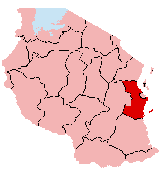 Pwani / Coast Region is among of the Tanzanian Coastal Region and is one of Tanzania’s 31 administrative regions with the total area of 32, 547 km2 (12,566 sq. mi). the regional capital is Kibaha town council.
- Borders: The Pwani (Coast) Region is bordered by Tanga Region to the North, Dar es Salaam Region and the Indian Ocean to the East, to the South by the Lindi Region and Morogoro to the West.
- ADMINISTRATION
Administratively, Pwani (Coast) Region is made up of 7 districts namely Bagamoyo, Kibaha TC, Kibaha DC, Kasarawe, Mafia, Mkuranga, and Rufiji.
TOURISM ATTRACTIONS IN PWANI (COAST) REGION
- Historical town of Bagamoyo
- K.Nyerere National Park (Formerly Selous Game Reserve)
- Wami River
- Kaole Ruins
- Saadani National Park
- Mafia Island and Marine Park
- Rufiji River
Background information; by edgardowelelo@yahoo.com
 Mtwara Region is among of the Tanzanian Coastal Region and is one of Tanzania’s 31 administrative regions with the total area of 16,710 km2 (6,450 sq. miles). The regional capital is the municipality of Mtwara (Mtwara urban – including Mikindani).
- Borders; The boundary with Mozambique to the south is formed by the Ruvuma River. To the west, Mtwara is bordered by Ruvuma Region, to the north by Lindi Region, and to the east is the Indian Ocean.
- ADMINISTRATION
Administratively, Mtwara Region consists of districts namely, Mtwara Urban (Mtwara Municipality – including Mikindani), Mtwara Rural, Tandahimba, Newala, Nanyumbu and Masasi (Masasi Town Council & Masasi Rural).
- GEOGRAPHICAL LOCATION
Mtwara Region is situated in the southeastern part of Tanzania.
- GETTING TO MTWARA
By water transport through Indian Ocean as well as by road and air networks.

- MTWARA REGION AT A GLANCE
The history of Mtwara Region is traced through the historical town of Mikindani which was an important export point for traders from Malawi, Zambia, Angola, and Democratic Republic of Congo (DRC). The traders from the Arabian Peninsula settled at Mikindani in the 9th and 18th centuries and by the second half of the 15th.
- PEOPLE
Bantu group indigenous of Makonde, Makua and Yao.
- SIZE / AREA
16,720 km2 or 1.9 percent of the country’s mainland mass. Mtwara is the third smallest regions in Tanzania by size after Kilimanjaro (13,209 km2) and Dares Salaam (1,339. 59 km2).
TOURISM ATTRACTIONS IN MTWARA REGION
- Ruvuma River
- Paul’s Church
- Whale sighting during October / November breeding time and also dolphins in the Marine Park.
- Untouched beaches at Msimbati and Msanga Mkuu.
- Mnazi Bay Ruvuma Estuary Marine Park.
- Newala Old Boma, Makonde arts, Carvings and dances
- Game reserves of Lukwika / Lumesule migration corridor between Selous Game reserve (currently J.K.Nyerere National Park) and North – East Mozambique (Niassa).
- The historical town of Mikindani which was an important export point for traders from Malawi, Zambia, Angola and Democratic Republic of Congo (DRC).
Background information; by edgardowelelo@yahoo.com
 Lindi Region is among of the Tanzanian Coastal Region and is one of Tanzania’s 31 administrative regions with the total surface area of 67,000 km2 of which 18,000 km2 are under the famous SELOUS GAME RESERVE (currently upgraded as J.K.Nyerere National Park). The Region’s area is 7.1 percent of the Tanzania mainland. Lindi is a coastal town located at the end of Lindi Bay, on the Indian Ocean in south eastern Tanzania. The town is 450 kilometers south of Dar es Salaam and 105 kilometers north of Mtwara, the Southernmost coastal town in Tanzania, and gives its name to the surrounding Lindi Region, one of the most sparsely populated areas of the country.
- BORDERS: The Lindi Region borders Pwani (Coast) and Morogoro Regions in the west, Ruvuma Region in the southwest, and Mtwara Region in the south. Much of the western part of the Lindi Region is in the SELOUS GAME RESERVE (currently upgraded as J.K.Nyerere National Park).
- LOCATION
Lindi is located in the mouth of the LUKULEDI River.
- ADMINISTRATION
Administratively, Lindi Region is divided into 5 districts namely, Ruangwa, Nachingwea, Liwale, Kilwa and Lindi (Lindi Urban (Municipality) MC & Lindi Rural).
- CLIMATE
Due to its geographical location, adjacency to the Indian Ocean Shoreline, the weather in Lindi is tropical and humid.
- PEOPLE
Ethnic groups of Makonde, Makua, Mwera, Matumbi and Magingo. Makonde are found in Lindi, Kilwa and Nachingwea districts. Makua are found in Nachingwea district. Mwera are found in Lindi, Nachingwea, Ruangwa and Kilwa districts, while Matumbi are found in Kilwa and Liwale districts and Magingo are found in Liwale district.
- LINDI REGION AT A GLANCE
Lindi Region is in the South eastern part of Tanzania mainland and is among of the coastal Regions. It lies between Latitudes 7 degrees 55 south and 10 degrees and Longitudes 36 degree 51’ E and 40-degree E. The word Lindi means a floating buoy or buoyant and it is home to Dinosaurs at Tendaguru.
- BORDER REGIONS
 Lindi Region has a common border with Morogoro and Pwani (Coast) regions in the west and Ruvuma Region in the Southeast. It also shares borders with Mtwara Region in the south and Indian Ocean in the East. Much of the western part of the Lindi Region is in the SELOUS GAME RESERVE (currently upgraded as J.K.Nyerere National Park).
TOURISM ATTRACTIONS IN LINDI REGION
- Kilwa Kisiwani (Kilwa on the Island) Learn more
- Kilwa Kivinje (Kilwa of the casuarinas trees)
- Kilwa Masoko (Kilwa Market)
- Kilwa Kipatimo
- Songo Mnara Islands. Learn more
- Dinosaurs Fossil at Tendaguru, and many more.
- BEST TIME TO VISIT LINDI
The best time to visit the town or region is between the months of May and September, when the weather is relatively cooler.
- GETTING TO LINDI REGION
Lindi Region can be reached easily by either road, sea and air transport services.
- WHAT TO DO IN LINDI REGION
Sunbathe, motor sport, hiking, strolling, diving, fishing, fishing sport, swimming and many more.
Background information; by edgardowelelo@yahoo.com
 Tanga Region is among of the Tanzanian Coastal Region and is one of Tanzania’s 31 administrative regions with the total surface area of 27,348 km2 (3 percent of the total area of the country).
- LOCATION
Tanga Region is situated at the north – eastern corner of Tanzania, the Region of Tanga links the well – known Kilimanjaro Region with Dar es Salaam in the south as well as Pwani (Coast Region) and Kenya in the north.
- ADMINISTRATION
Administratively, Tanga Region is made up of districts namely, Pangani, Mkinga, Kilindi, Muheza, Tanga City, Handeni, Korogwe and Lushoto. Tanga City, is the headquarters of Tanga Region, and the biggest town and economic center of the Region.
- CLIMATE
The coastal area is warm with an average temperature of around 28°C. Sea breezes make the climate very pleasant all year. The hottest months are from October to February. The main rainy season is from April to late May where it rains mostly at night, leaving the day with bright sunshine.
- PEOPLE
Ethnic groups of Bantu speaking – peoples mainly, Wadigo, Wasambaa, Wanguu, Wabondei and Wazigua.
- TANGA HISTORICAL BACKGROUND
 Tanga Region on the Tanzanian northern coast close to the Kenyan border has a fascinating history as one of the oldest settlements along the East African Coast. The word “Tanga” means “Sail” in the Kiswahili language, an indication that the protected Tanga Bay has over many centuries offered a safe haven for local fishers and the thriving Indian Ocean trade along the East African Coast. Another translation of “Tanga” refers to the Bondei word “Farm”. Tanga and Pangani became important trading centers for slaves and ivory when the Sultan of Muscat and Oman moved to Zanzibar in 1832 and controlled a coastal strip of 10 miles inland of the East African Coast. In the scramble for Africa over the last decades of the 19th century, German commercial interests and later the German government conquered the inland, bought the coastal strip from the Sultan and developed the colony as “German East Africa.” With its protected port and fertile hinterland, especially in the Usambara Mountains, Tanga became a center of German Colonization and also an administrative center up to 1890 when Dar es Salaam was made the capital of the emerging colony. Rapid colonial infrastructural and economic development followed from 1889 after the end of the bloody “Bushiri war” – an uprising of local Arab rulers (accused of being slave – traders by the Germans) and their followers against the German occupation and the sale of the coast by the Sultan. To open up the hinterland and especially the fertile and cool Usambara Mountains for economic development and trade, a railway was built from Tanga to Moshi and a road network developed, including the scenic winding paved road from Mombo up the Mountains to the emerging district center WILHELMSTHAL (Now Lushoto).
- TANGA REGION AT A GLANCE
Tanga Region has a rich history which unfolds real and interesting stories of explorers like Vasco da Gama, Arab and Asians, trading activities, slave trade, the advent of German colonists and finally the British rule. The capital of the region is situated on the shores of the Great Indian Ocean from where all activities radiate towards other parts of the region. The city is rich in history, natural attractions, period architecture and interesting aquatic species. South of Tanga lies a prominent trading center of the 19th century, PANGANI. Pangani has some of the most spectacular unpolluted beaches in the country and is an excellent beach holiday destination. To the further south is the little known SAADANI NATIONAL PARK with beach and wild animals that enjoy the sea breeze. To the west of Tanga and on the East Usambara Mountains lies a beautiful hill station – AMANI NATURE FOREST RESERVE(ANFR). This is the nest of flora and fauna.
TOURISM ATTRACTIONS IN TANGA REGION
- Saadani and Mkomazi National Parks
- Amani Nature Forest Reserve, Coelacanth Marine Park and Maziwe Island Marine Reserve.
- Visiting the long Indian Ocean Coastline with its sheltered bays and Lagoons, such as Moa Bay, Manza Bay, Kwale Bay, Tanga Bay and Mwambani Bay as well as Kigombe, Pangani and Ushongo Beaches.
- Visiting the historic Tanga city center and off – shore islands such as TOTEN, ULENGE, YAMBE and KARANGE, MAZIWE ISLAND off Pangani, nearby Amboni Caves, Gallanos Hotsprings and Tongoni Ruins.
- Visiting TANGA MUSEUM.
- Visiting Usambara Mountains, NILO NATURE RESERVE and MADALA HOMINID FOOTPRINTS.
- Visiting Mambo Caves and Ndemaha waterfalls, and many more.
Background information; by edgardowelelo@yahoo.com
 Tabora Region in Brief
- The Tabora Region, of which Tabora city is the capital, is to be found in the north – western quarter of mainland Tanzania. It shares its borders with six (6) regions. Moving clockwise from the north, they are Shinyanga and Simiyu (north), Singida (east), Mbeya (South), Katavi (Southwest) and Kigoma (west). Tabora is physically the largest of Tanzania’s 31 regions, with a surface area of 76,151 sq. km, just over two – thirds of this consists of Forest Reserves (34, 698 Sq.km) and Game Reserves (17,122 Sq. km). Most of the region lies at an altitude of 1,000 – 1500m (the city’s altitude is 1000m) and has a moderate tropical climate, with temperatures reaching their peak in September – October, just before the start of the rainy season. Rainfall is seasonal and occurs mainly from November to April. In the western parts, rainfall totals over 1000mm, while in the east it drops to 700 mm or less. The daily mean temperature is around 23 degrees C. There is a slightly cooler period from May to July, when temperatures can drop to 14 degrees C at night, although they reach 28 – 30 degrees C during the day. Economic activity in the region revolves around farming and livestock keeping, along with related activities such as bee – keeping, fishing and lumbering. The region is estimated to have 2. 4 million ha of cultivable land but less than a fifth of that is actually under cultivation. Most farming is subsistence farming, with maize the leading staple food. Other food crops are rice, sorghum, cassava, and beans. Cash crops are tobacco, cotton, sunflower and groundnuts). Administratively, the region consists of seven (7) districts: Nzega and Igunga (north), Tabora urban (center), Uyui (east), Sikonge (south) and Urambo and Kaliua (west).
Tabora Region Historical Background
- Tabora was founded in the mid - 19th century by Arab traders and lay at the junction of major caravan routes. It was taken over by the Germans in 1891 and became an administrative centre of German East Africa. The name Tabora is said to have originated in the word “Matoborwa” meaning boiled and dried sweet potatoes, a staple food of the Nyamwezi who are the main ethnic group in the region. The town was an important mission station during the early years of the European exploration of East Africa. Stanley and Livingstone stopped in Tabora after their famous meeting in Ujiji (near Kigoma) in late 1871. The Arabic – style house where Livingstone stayed in Tabora is now the Kwihala Museum, which is dedicated to Livingstone and contains his memorabilia including letters, maps, pictures and a diary. It also displays information about other early missionaries and explorers. Tabora is also known for its educational institutions. President Nyerere himself, the founding father of the nation, went to the Tabora Government Secondary School, the first boarding school in the country, and thought highly of it.
Tourism Attractions in Tabora Region
- The major reserve in the region is the Ugalla Game Reserve (Established in 1965 – currently upgraded and established as a National park, and is known as ‘UGALLA RIVER NATIONAL PARK’. This national park is found in Tabora and Rukwa) respectively, with an area of 5,000 Sq. km that supports a large variety of game congregating in the vicinity of the Ugalla River in the dry season. Ugalla River National Park is about 200 km from Tabora city and is characterized by two primary ecosystems: extensive miombo woodland and large floodplains. An estimated total of over 50,000 animals inhabit in Ugalla River National Park for all or part of the year.

The species include lion, leopard, elephant, hippo, giraffe and buffalo, as well as impala, waterbuck, topi, wild dog and warthog. The other major reserve is the Kigosi (Established in 1983 – currently upgraded and established as the National Park and is known as Kigosi National Park, this national park is found in Kigoma, Tabora and Shinyanga regions, and is larger than Ugalla River National Park (7000 Sq.km). The Kigosi has wildlife similar to that in Ugalla. Visitors or tourists can reach the park by the trunk road from Tabora to Mpanda, in Katavi region. In addition to the National parks in Tabora region, there are also a number of tourist attractions within the city of Tabora itself. As widely known, Tabora was founded in the mid – 19th century by Arab slave traders and was a major trading point and stopover for caravans connecting Lake Tanganyika and central Africa with the coastal town of Bagamoyo to the north east. It was also an important mission station during the early years of the European exploration of East Africa. Stanley and Livingstone stopped in Tabora after their famous meeting in Ujiji (near Kigoma) in late 1871. The Arabic – style house where Livingstone stayed in Tabora is now the Kwihala Museum, which is dedicated to Livingstone and contains his memorabilia, including letters, maps, pictures and a diary, it also displays information about other early missionaries and explorers. After the German takeover, Tabora became an administrative centre of German East Africa. The construction of the railway made it even more important. The German Fort Boma, which housed the administrative offices, can be seen in Tabora today. It is still in use (by the military) and is connected with the Tabora railway station by means of an underground tunnel (which is not in use). Other points of interest in the city include the Tabora Boys Secondary School which president Nyerere attended: and the varieties of architectural styles – African, European, Indian – to be found in the city’s buildings.
Background information; by edgardowelelo@yahoo.com
 Kagera Region takes its name from Kagera River. Situated in the northwestern corner of Tanzania, Kagera region is endowed with abundant tourist attractions. Kagera’s landscape in general is beautiful, its rock scenery magnificent, with the climate at 1,100 meters above sea level very pleasant and the lagoons in lake Victoria competing the picture. As a whole the region has unique collection of Flora and Fauna and is a paradise for the world bird lovers. Kagera has around 450 different species of birds of Tanzania’s total of 1,100 species of birds. The region is rich in mineral resources with gold found in Biharamulo district and nickel in Ngara district. Kagera region has 5 game reserves, and all of these game reserves have now been upgraded and established as National parks, including Biharamulo (Established in 1959, with an area of 1,300 sq. km), Burigi (Established in 1972, with an area of 2,200 sq. km), Kimisi (1,026 sq. km), Rumanyika (Established in 1965, with an area of 800 sq. km), and Ibanda (Established in 1972, with an area of 200 sq. km).
Tourism Attractions in Kagera Region
- Kigarama, Katoke and kyamunena falls.
- Kamuli hotsprings in Karagwe district.
- The paintings in Busota caves, wood carvings and handcrafts.
- Hotsprings of Mutagata, the yerusalemu caves and Ruvuma falls.
- Kagera River which is the source of Nile River, traditional Bahaya life where you can learn a lot from them.
- The traditional houses of chief Rumanyika of Karagwe at Bweranyange, chief Kasusura of Biharamulo and chief Bahamba of Ngara.
- Kyaka Bridge and church demolished during the Idd Amin war and Hero monuments.